Vale of Pewsey. nr Oare. Wiltshire.
Reported 21st June.

Map Ref: 

This Page has been accessed
Hit Counter


Updated Tuesday 22nd June 2010


AERIAL SHOTS GROUND SHOTS DIAGRAMS FIELD REPORTS COMMENTS ARTICLES
21/06/2010 22/06/2010 22/06/2010 22/06/2010 22/06/2010 22/06/2010

Image Olivier Morel Copyright 2010


Image Free Spirit Copyright 2010

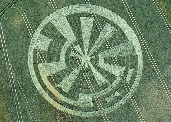
Attached is a picture of the Oare Circle from the hillside directly above. It can be viewed from this position legally without offending any farmers. A public bridleway exists from the main road at the highest point, 1 mile north of Oare , to Huish Farm OS Map ref 154638, from which a signposted public footpath/bridleway leads SSW across two gated fields, leading to this viewpoint.
 
Free Spirit


AERIAL SHOTS GROUND SHOTS DIAGRAMS FIELD REPORTS COMMENTS ARTICLES

BACK

  
Mark Fussell & Stuart Dike