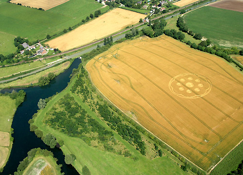
Stuart/Mark – This afternoon, Wed 18 July 2007, my wife and I
discovered a new formation while we were driving between Burbage
and Great Bedwyn across the canal toward the Wilton Windmill.
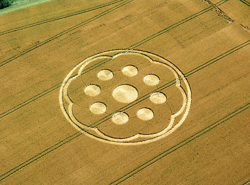
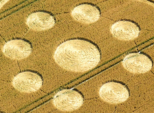
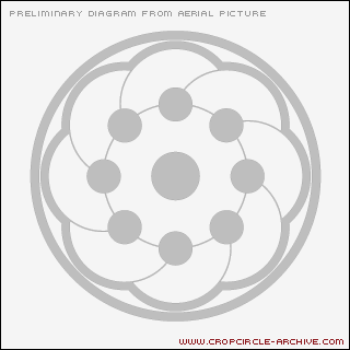
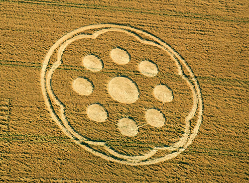
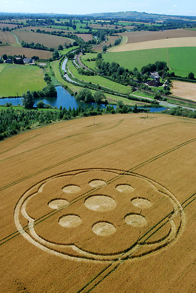
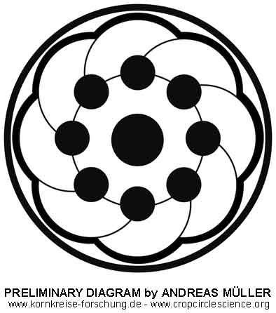
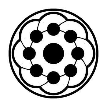
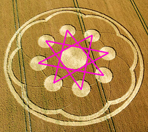
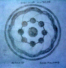
I have attached two photos and a drawing from ground
observations. The formation is approximately 300’ across with a
central large circle, eight orbiting additional circles,
surrounded by a ribbon of partial circular arcs all contained
within a 300’ ring. This is also the first formation in OATS
that we’ve come across. The oats were about 4’ tall.
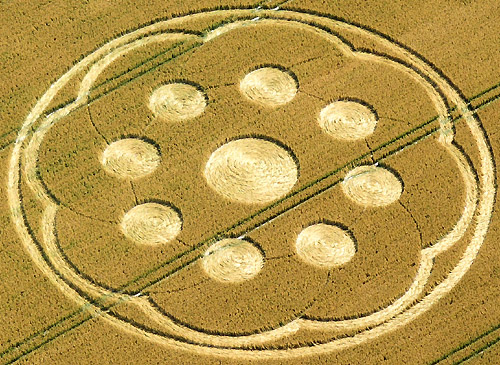
The formation was in pristine condition when we approached
it. The central circle had no entry paths, even from tram
lines. All of the lay was clockwise and quite fluid and
fluffy. We can confirm that the formation was not in the field
yesterday evening as we have observed it each day for the past
week.
Images and Diagram Ross and Meredith
Holcomb Copyright 2007
Ross and Meredith Holcomb
|