|
|
CROP CIRCLE RUMOURS 2006 (23 rumours) Updated Wednesday 23rd August 2006
|
|

Discuss the rumours on the Forum
|
FOR VISITING THE CROP CIRCLES. |
| Location: | To South of A47 West of Acle (where road becomes single lane) |
| Map: | |
| Crop: | It's been cut, but new grass clearly shows design. |
| Description: | Can not be seen in full (see photos sent by separate e-mail) |
| Discovery: |
I'm sending this report as you do not seem to have it on your site. |
| Name: | Patricia |
| Status: | Waiting for pictorial evidence |


Images Guy Osborne Copyright 2006
| Location: | Bearsted, Kent |
| Map: | TQ805563 |
| Crop: | it�s a logo design for a local company |
| Description: | |
| Discovery: |
08th August |
| Name: | Andy Fowlds |
| Status: |
I
received an email to our website last night (08th August)
that reported a sighting of a NEW crop circle near Bearsted, Kent.
We can confirm it�s a logo design for a local company� its pretty
big though, around 300ft in diameter� I went to view from the road
this lunchtime. Graham and I will go and check it out later on all
the same, just to see what it looks like on the ground � maybe get a
few photos. I will update our website later with the news.
Can be viewed from Water Lane, just before the road goes under the motorway M20. It�s located near Bearsted, Maidstone, Kent seen from the left hand side of the Motorway between Junction 7 and 6 heading London bound. I�ll try and get more details of what the Logo design is and why it was made etc� |

|
This 300 ft circle was reported on 8th August. It was reported on a local radio station (KMFM) that it was commissioned by the Bearsted Round Table. I believe you'll find that the design, if viewed from the air, would loosely be based on the Round Table logo. Graham Tucker |
| Location: | On the northbound side of the M11 just north of Saffron Walden |
| Map: | TL501408 |
| Crop: | Wheat |
| Description: | Large, round with 3 projections |
| Discovery: |
7th August, 2006 |
| Name: | Matthew Briggs |
| Status: | Waiting for pictorial evidence |

To Peter Sorensen 2006 home page
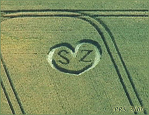
The Numbers Crop Circle 2nd August 2nd August
Image
Peter R Sorensen
Copyright 2006 The Valentine for
SZ is in West Overton, in wheat. I�m surprised there aren�t more
of these romantic messages! It looks quite fresh, so it would
have been made in mid-July. 30-7-2006 11.00 3
minutes before entering the Eurostar tunnel to France 30/07/06 at 1.30pm
in the afternoon " I also found the 1996 littlebury Green formation,
where this circle looks near to!!
by Wolfgang Wiedergut
Location:
Near
Winchester, Hampshire.
Map:
Seen
briefly from the train, will visit tomorrow, take pictures and send
them to you ASAP
Crop:
Barley
Description:
three
or four rings, from small to bigger, all inside the biggest circle
Discovery:
Name:
Janez
Ferjancic
Status:
Waiting
for pictures
Location:
Barton
farm, Winchester, Hampshire
Map:
Crop:
Wheat
Description:
A
flattened circle with patterns inside and a outer ring twice the
size
Discovery:
Name:
Eldon
Griffiths
Status:
Waiting
for picture evidence
Location:
On the
right side of the train track just before entering a tunnel
Map:
Along
the railway track 3 minutes before entering the EuroStar train
tunnel towards France
Crop:
Probably wheat
Description:
Geometric flower peddles (difficult to see so fast)
Discovery:
Name:
Ray
Postema
Status:
Waiting
for pictorial Evidence
Location:
Between
Stansted & Cambridge on the M11 Motorway just before Junction 9
heading north
Map:
Grid
reference at centre -
TL485385 GB Grid - As near as can get
Crop:
Wheat &
Quite a large formation!
Description:
Circular with a few outer & inner rings looks almost 3D in shape
with Lunulas & sways
Discovery:
Name:
R Howe
Status:
Waiting
for pictorial Evidence

|
This picture was taken by Werner Anderhub showing from Woodborough Hill looking down on the current commissioned man-made formation by Simeon Hein, Peter Sorensen & Co made in broad daylight of two days with permission of the farmer. |
| Location: | Vicinity Buckworth, UK and Old Weston, PE28 5LL |
| Map: | TL101775 Location is at 511600E 277640N (N52:23:08 W0:21:42) |
| Crop: | Unknown |
| Description: | Rumours flying around work haven't seen it yet! |
| Discovery: |
27 July 2006 and 19th July |
| Name: | John Doe and Greg Berry |
| Status: | Waiting for Photographic Evidence |
| Location: | Off the A602 nr Sacombe, Herts. |
| Map: | |
| Crop: | Unknown |
| Description: | 6 circles, 3 closely connected in the middle row, 2 either side of the main 3 with one random circle to the right and below the formation. |
| Discovery: |
4th July |
| Name: | Tony Nash |
| Status: | Waiting photographic evidence |
| Location: | There are TWO more circles near Cess road Norfolk one Repps Road and near A47. North Burlingham |
| Map: | TG 466178 |
| Crop: | Barley |
| Description: | |
| Discovery: |
|
| Name: | Steve Vivs mate |
| Status: |
Formed in barley, just outside Martham on the road to Hemsby, this formation is not visible from the road (the field slopes downwards from it), but is only a few yards, and therefore visible, from the footpath which runs down the side of the field. Overall diameter: 100'. Most of the crop is swirled anticlockwise, but the outer circumference consists of a 2'-wide band of clockwise swirl. John Sayer |

| Location: | Datchworth lane Hertfordshire |
| Map: | |
| Crop: | Wheat |
| Description: | series of different sized circles 10 in total in a T shape |
| Discovery: |
Sunday 9th July |
| Name: | Richard from Stevenage, Herts |
| Status: | Waiting for photographic evidence |
| Location: | Patney, Wiltshire. (nr. Alton Barns) beside road bridge northern outskirts of Patney. | |||
| Map: | unknown | |||
| Crop: | Wheat | |||
| Description: | Huge disruption/formation of crop over a large area extending hundreds of metres, difficult to decipher what it is without aerial shot | |||
| Discovery: |
Saturday 8th July 06 |
|||
| Name: | Billy Mcleod and Shirley Chaplin | |||
| Status: |
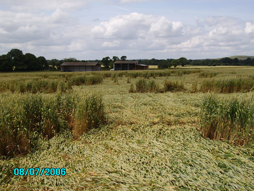
From Billy Mcleod in Wiltshire, saw this formation/disruption in a field on Sat. 8th July. The field is alongside the road bridge over the railway line at the northern outskirts of Patney village near Alton Barns. Went into field via a track which runs along eastern edge of crop. The local experts at Silent Circle Cafe are mystified by the scale and form of the disruption. An aerial picture of the field would help as it is unclear on the ground what we have here. Images Billy
Mcleod copyright 2006
|

| Location: | Possible formation mentioned to me word of mouth-East Side of M11 in between Duxford and Hinxton |
| Map: | TL482443 |
| Crop: | Unknown |
| Description: | Again vaguely described by someone who knows my interest on a mobile as they passed as many circles linked by shape/formation by electricity pylons |
| Discovery: |
07/07/06 |
| Name: | Matt |
| Status: | Waiting for aerial shots and exact location |
|
Date:
Wed, 5 Jul 2006 15:08:43 |
| Location: | Manningtree Station, nr St Edmund Way, Essex. |
| Map: | TM089321 |
| Crop: | n/a |
| Description: | The crop circle in on side of the station at Manningtree Rail Station where the train comes in from Leeds. Its the Leeds to Harrage railway line. |
| Discovery: |
15th June |
| Name: | Gordon Murphy |
| Status: | Waiting for pictorial confirmation by a researcher |
| Location: | Barling, Southend, Essex |
| Map: | n/a |
| Crop: | Corn |
| Description: | 120 ft disc with crescent |
| Discovery: |
27th June |
| Name: | Catherine Lewis |
| Status: | Waiting for pictorial confirmation |
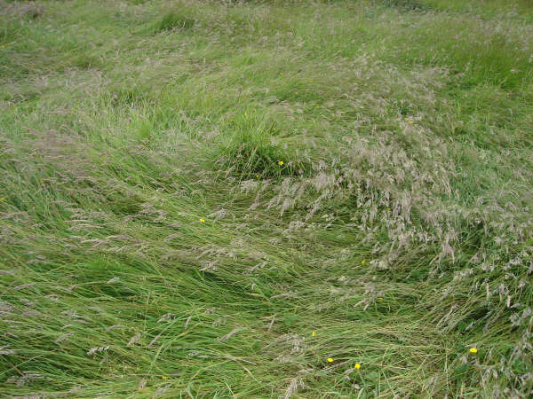
| Location: | Denton near Oxford | ||
| Map: | SP591025 | ||
| Crop: | Grass | ||
| Description: | Hard to make out but it looks like a flattened area/curved shape with straight edges, close to a footpath as well. | ||
| Discovery: |
19/06/06 |
||
| Name: | Julian Auger | ||
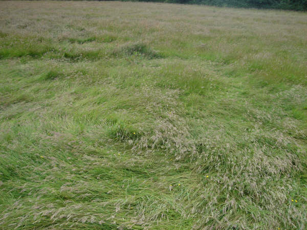
| Status: | Geoff
and I visited the Denton grass circle today (around 2.30pm 20th
June). There is a lot of wind damage in the field. The formation
itself appears to have been down a while and is severely blown
about. It is impossible to ascertain its original pattern but
appears to be a large tracked circle with off-shooting tracks. One
very long trail. From nose to tail seems to be about 30 plus metres.
No energy to it at the time of visiting. Ellis C Taylor Click on thumbnails below to enlarge Images Ellis C Taylor Copyright 2006
|
| Location: | Oxfordshire |
| Map: | |
| Crop: | Wheat |
| Description: | Single large circle (?) on 'Round Hill' between Chalgrove and Stoke Talmage. Visible from nearby trading depot. |
| Discovery: |
16th June 2006 |
| Name: | Susan |
| Status: | Waiting
for confirmation on the ground from a researcher We also attempted to locate the circle near Chalgrove last night - all we found was a wild-eyed guy with a shotgun and a belt full of ammo. Ellis C Taylor |
|
Inspirational Sculpture Show in
Crop Circle Country.
|


| Location: | Wilsford Down, near Great Durnsford). Near Upper Woodford (between Salisbury and Stonehenge) Wiltshire |
| Map: | |
| Crop: | |
| Description: | Formation reported as a formation comprising three aligned circles in a field. |
| Discovery: |
28th May 2006 |
| Name: | David Russell |
| Status: | Waiting for confirmation |

Image The Wiltshire Gazette and Herald Copyright 2006

| Location: | Baltic Farm, near Avebury, Wiltshire. |
| Map: | |
| Crop: | Oil Seed Rape |
| Description: | See Picture above. |
| Discovery: |
Reported 18th May 2006 |
| Name: | Andreas M�ller |
| Status: |
The first formation of this
year in Wiltshire (Baltic Farm, near Avebury) is nothing but an
advert stunt. The local "Gazette & Herald" newspaper has hired a
team of local hoaxers to stomp its logo into a field of oilseed
rape. The result is described as 300ft large - but the aerial reveals that is is rather messy than massive as the letters "H&G" have a rather crooked appearance like a little kids first writing.
http://www.cropcirclescience.org
|
| Location: | Alfriston, East Sussex |
| Map: | |
| Crop: | |
| Description: | I've just had a report of a possible simple circle in Alfriston, East Sussex.... as you go down the hill from High and Over you can see it in one of the rape fields at the top. Informer didn't know for definite if it was one so I'm off to check it out to day and see if I can find it! |
| Discovery: |
Reported 28 Apr 2006 07:21 am |
| Name: | Non-refundable on The Crop Circle Connector Forum |
| Status: | Waiting
confirmation with pictures. I went out to have a look and there is nothing I can see anywhere around there - just an old wall with some grass that might have fooled your reporter. False alarm in my opinion.
Andy Thomas
|
| Location: | |
| Map: | |
| Crop: | |
| Description: | |
| Discovery: |
|
| Name: | |
| Status: |
![]()
Image Use Policy (Please Read)
CHECK THE WEATHER FOR VISITING CROP CIRCLES
The Crop Circle Connector suggests you
visit the link below
before visiting this year's crop circles in England.
Follow the Countryside Code whilst visiting Crop Circles

![]()