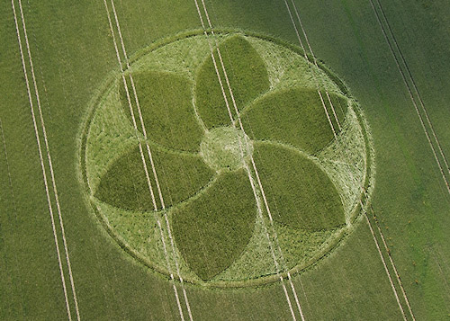
Thanks to my vigilant pilot who noticed this
Flower formation on Clatford Down a few days ago, we flew yesterday
evening (June 22) and got some shots of it before it got too old --
he was dodging rain clouds along the way!
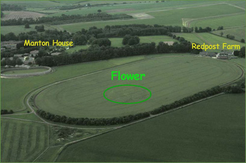
It’s located inside an oval gallops (that’s a
first!) between Manton House and Redpost Farm, at approximately SU
155-705 on the Ordnance map.
Because of the poor lighting conditions I boosted
the contrast and colour with Photoshop. (I’ve noticed on the Forum
that some people complain about that. But I promise you wouldn’t
like the very dark and dull original images. And you wouldn’t be
able to see much detail if I didn’t use the sharpening filter. It’s
bad enough as it is, shooting with a video camera!)
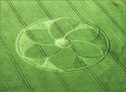
Here’s a shot that locates the formation on the
ground. This shows you how the pictures look without any Photoshop
tweaking.
Peter Sorensen |