|
|
|
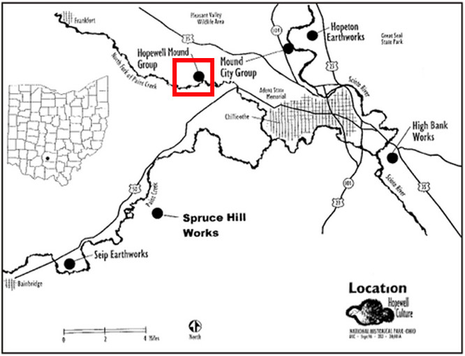
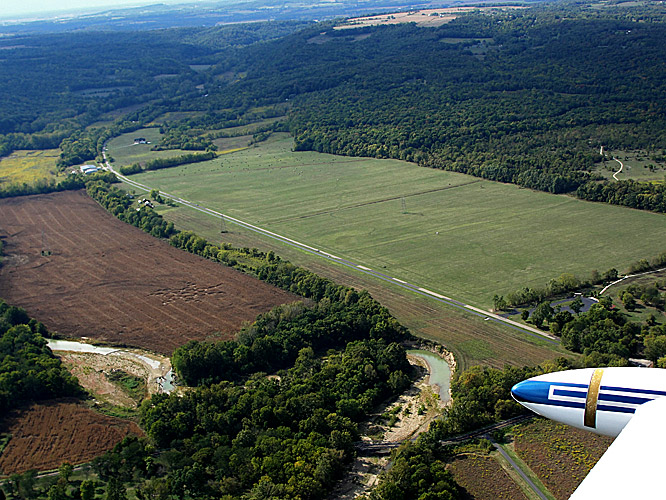
Hopewell Mound Group, nr
Chillicothe, Ohio. Reported 20th September.
Map Ref:
This Page
has been accessed

Updated Monday 5th November 2012 |
|
| AERIAL SHOTS |
GROUND SHOTS |
DIAGRAMS |
FIELD REPORTS |
ARTICLES |
|

NOTE: THE LANDOWNERS ARE NOT GRANTING PERMISSION TO VISIT
THIS FORMATION TO ANYONE, EXCEPT FOR AN INVESTIGATION ESCORTED BY THE
FARM MANAGER. PLEASE RESPECT THE LANDOWNERS' PROPERTY RIGHTS AND DO NOT
TRESPASS!
|
My sister saw a Crop
Circle from a airplane last week. Her name is Caryn and her
friend is Bob. She asked Bob to take some pictures for me as
she knew I was a believer in extraterrestrial life. I know
the serpent mound is the ancient energy place so I believe
that the crop circle appeared just when they arrived just
for them. My sister just told me Bob got a little bit sick
in the airplane so I think also that the crop circle leaves
lots of energy and have been known to make people fell ill
when they are near them. Maybe that being close to the
serpent mound was way to much energy for Bob. I never
thought I could report a crop circle, but since I have lots
of energy into my beliefs, it has come true. Shout out to my
friend Patrick he is real good in photoshop and I-movie
maker He said he will help photoshop more pictures when he
gets his days off and he has put the I-movie on youtube.
this is the link:-
WATCH
She said the Crop Circle is at an
ancient place called Hopewell Mound Group. But when Bob took
her for a ride and saw the Crop Circle on the way out to
Serpent Mound.
Kevin Williams |
 |
High Strangeness in
43-Circle-Corn Pattern
Near Ancient Mounds of Chillicothe, Ohio
© 2012 by Linda Moulton Howe
|


Images Bob
Copyright 2012 |
|

FOR VISITING THE CROP
CIRCLES.
|
|


No Less than the Trees and the
Stars
Art Work JW Copyright 2012 |
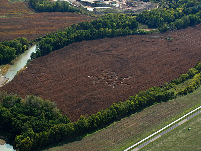
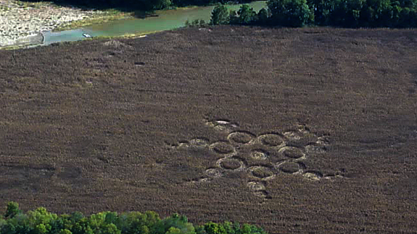
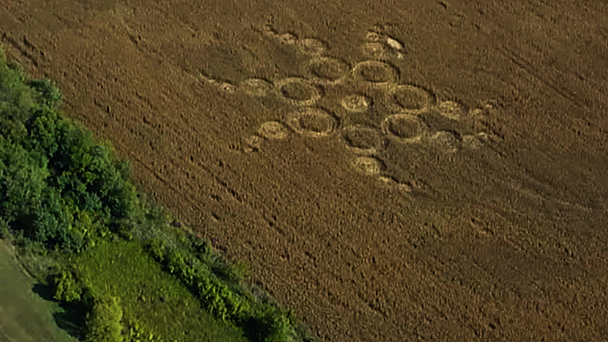
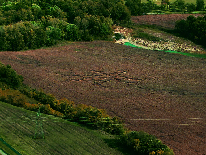
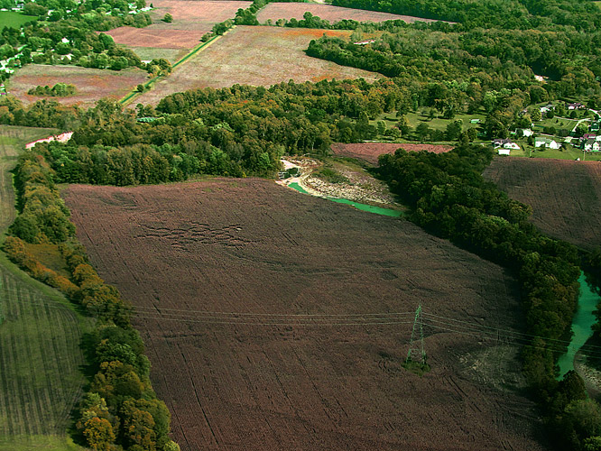
A few words about the recently reported
crop circle near the Hopewell Mound Group near Chillicothe,
Ohio: I spoke with the landowner and NOTE: THE LANDOWNERS
ARE NOT GRANTING PERMISSION TO VISIT THIS FORMATION TO
ANYONE, EXCEPT FOR AN INVESTIGATION ESCORTED BY THE FARM
MANAGER. PLEASE RESPECT THE LANDOWNERS' PROPERTY RIGHTS AND
DO NOT TRESPASS!
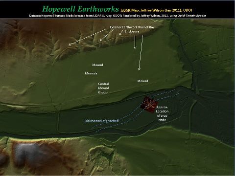
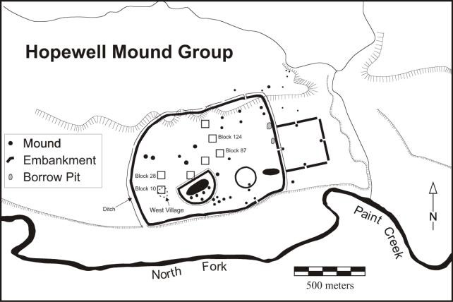
I've attached a 3-D LiDAR survey map that
I did a couple of years ago of the Hopewell Mound Group
pointing out the remnants of the earthwork walls and burial
mounds. I've also pointed out the location of the crop
circle in relation to the earthworks. Note that the crop
circle actually is located in the old channel of the
riverbed of the North Fork of Paint Creek (about 160 yards
to the south of the crop circle). The crop circle is about
100 yards south of the southern earthwork wall of the
enclosure, and about 330 yards east of some high tension
power lines. The crop circle is at least two weeks old based
on the timing of the Connector post and the content.
Ironically, I drove through the Hopewell
Mound Group just 8 days ago with Hugh Newman (of
Megalithomania fame) and remarked about this particular
field as being a prime candidate for a crop circle due to
the contextual markers (nearby water, power lines,
earthworks, low spot of area). The crop circle formation
must have been there, but it is not visible from any nearby
road.
Stay tuned - more to come as out
investigation progresses....
Jeffrey Wilson - To clarify the above
statement from the landowner - there will only be one
investigation done by the ICCRA, and we will be escorted by
the farm manager. They will not be allowing anyone else into
the field.
|
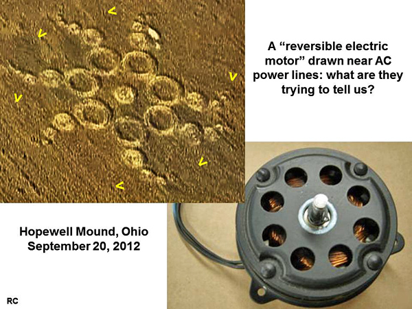

Jeffrey Wilson
has sent us in this really awesome diagram, with text, regarding the crop
formation at Hopewell Mound Group, near Chillicothe, Ohio, USA. Reported
20th September. Jeffrey's covering text - 'I was able to finally figure out
what the recent Chillicothe, Ohio crop circle formation design was: A
Heptagonal Hyperbolic Planar Tessellation. The crop circle design is based
on this particular fractal tessellation grid.' - More of Jeffrey's
information and photos on this crop formation can be found on this
Earthfiles link:
http://www.earthfiles.com/news.php?ID=2027&category=Environment
with hindsight, I am sending my consideration of
possible contexts of recent events in the U.S. with the crop circle of
20th September 2012 in Ohio, Hopewell Mound Group nr. Chillicothe. Crop
circle was 20th September 2012 near the town of Chillicothe - Ohio. This
city is located at the 39th parallel of north latitude. Sandy hurricane
struck the U.S. coast near Atlantic City, New Jersey. This city is also
the 39th parallel of north latitude. Crop circle consists of 34 rings.
Wrapping his arms demonstrates vortex effect formation. If we add 34
days to the date of crop circle, we get a date of October 24, 2012. This
is the day when the storm over the Caribbean Sea and reached hurricane
strength and was first struck the island country of Haiti, Jamaica and
Cuba.
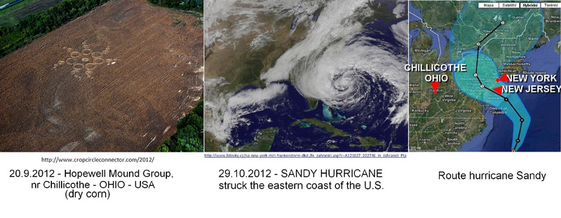
The hurricane also hit Ohio. Against this background, it can be
concluded that this crop circle formation of this devastating hurricane
predicted with incredible accuracy.
Pávková Z.
| AERIAL SHOTS |
GROUND SHOTS |
DIAGRAMS |
FIELD REPORTS |
ARTICLES |
|
|
|

BACK |

Mark Fussell & Stuart Dike |
|
|