|

|
|
Saint Johns
Church , nr Lawley, Telford. Shropshire. Reported 1st July.
Map Ref: SJ664090
This Page
has been accessed

Updated Monday 23rd July 2012 |
|

Discuss this circle on our Facebook
Crop Circles-UFO's-Ancient Mysteries-Scientific Speculations

CLICK HERE FOR THE LATEST CROP
CIRCLE CONNECTOR DVD
|
Images Jim Holmes Copyright 2012 |
|

FOR VISITING THE CROP
CIRCLES.
|
|
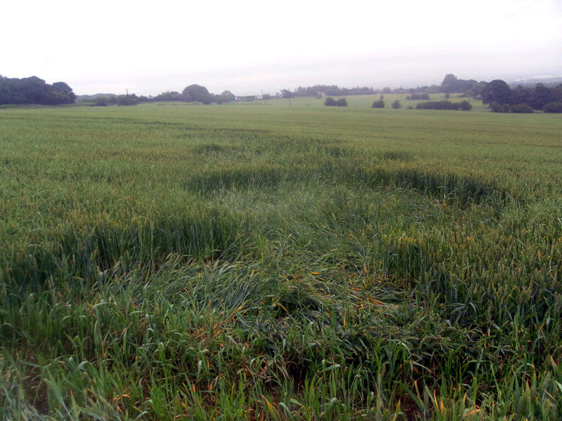
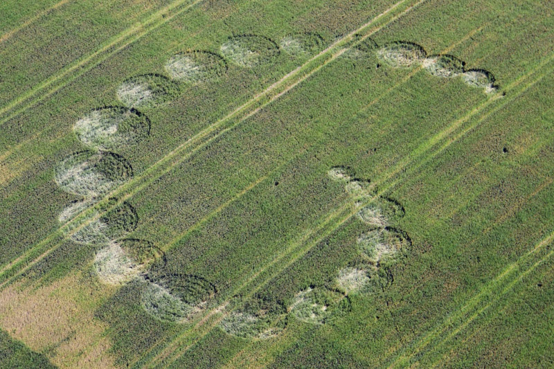
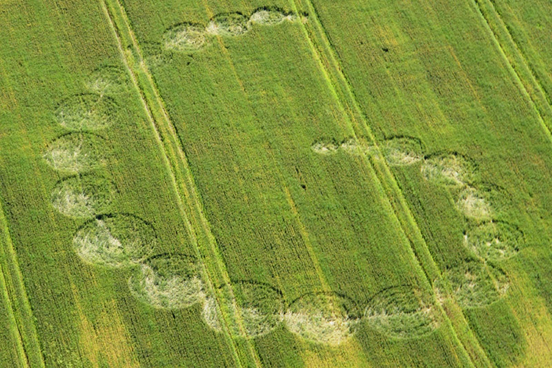
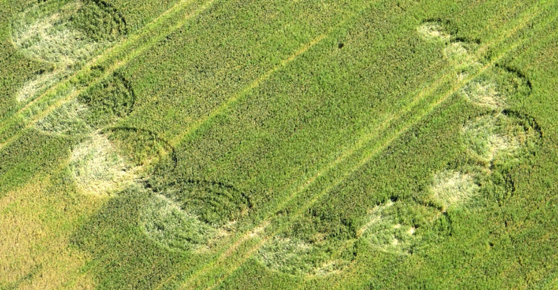
I was unable to find out who the landowner is , but
thought I'd take a walk in anyway , got thoroughly soaked , and had a
deer jump out at me , but got some close up photos. The Crop is
definitely wheat, I'm not sure how long this circle has been there as
the wheat is recovering well. None of the stalks were damaged in any
way, just bent over, and the crop appears to be layered in a clockwise
fashion through out all of the circles. There were no visible footprints
in or around the formation, and no obvious line in the the formation
from the tramlines.
There are around 15-20 circles joined together in a spiral formation,
starting out small from the inner spiral (literally a couple of feet
across) then gradually getting bigger (around 10-15 metres across)
before returning smaller as the spiral extends further out
Unfortunately I have not been able to get a clear shot of the whole
formation due the angle. There is a good vantage point, but its about 2
miles away on a footbridge, and my 12MP camera is no where near good
enough to pick out the detail.
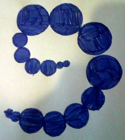
Quick sketch of my interpretation of the Lawley
circle , I can't guarantee accuracy , this is just my interpretation
from ground level what the whole thing would look like , and its not
to scale ( I had to use coins for the outline of the circles) bit
low tech but hopefully will give you the gist of it.
Michael Johns |
|

|
Location: |
In field of wheat next to Saint Johns
Church , in Lawley , Telford |
| Map: |
SJ664090 |
| Crop: |
Wheat |
| Description: |
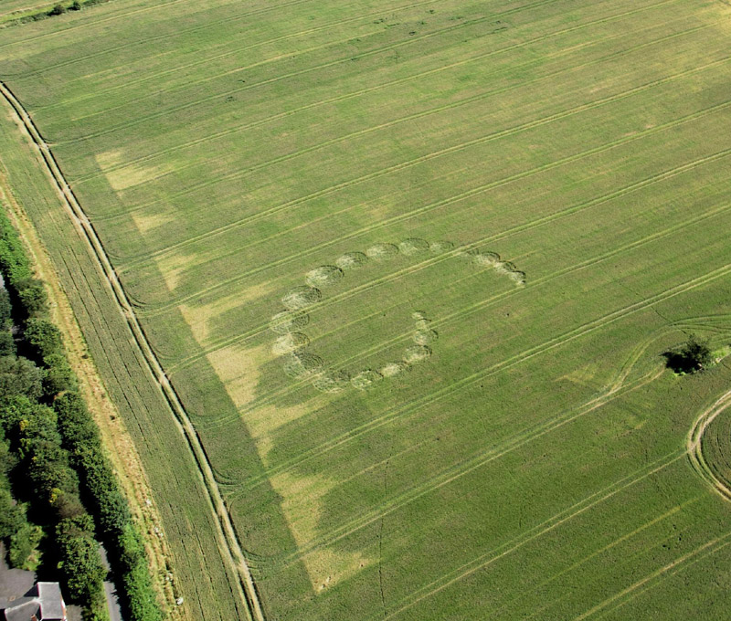
A few circles in what appears to be a
circular arrangement , not visible from roadside , can be seen from
distance (Lawley farm housing estate opposite) will email
photographic evidence when I have access to camera (camera phone is
low resolution to pick up formation) will attempt to get landowners
permission to enter the crop.
Update:-
As promised I have some pictures of
what appears to be a crop formation in the field as reported on
your website. Due to the low angle , its a bit difficult to make
out , and this was about the highest point I could find to take
some pictures , without breaking into a building site and
climbing a cement silo. Also I think my description was wrong ,
it looks like a series of circles in a spiral formation.
Still haven't found out who the landowner is to get permission
to have an up close look , but if I do will try and get some
ground shots.
This is definitely a formation and not wind damage , the
pictures just don't pick up enough detail from this angle I'm
afraid. Photos are coming over on a separate email
 |
| Discovery: |
1-07-12 |
| Name: |
Michael Johns |
| Status: |
Waiting for photographic Evidence |
|
Click above to join the Crop Circle Connector
Membership
|
|
|

BACK |

Mark Fussell & Stuart Dike |
|
 |