Here is my report and observations...
An
amicable but sceptical farmer kindly gave permission for myself and
friend to enter his crop field. He told me that it was defiantly not
there on Friday night (17th June).
Weather during formation appearance was mainly light rain.
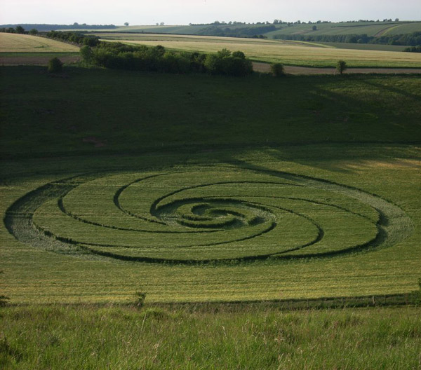
A
natural amphitheatre alongside the prehistoric Bluestone heath Road
is the spectacular setting for this eloquent formation.
·
Estimated at 267 feet in
diameter
·
Laid out on the lowest part of
the curved basin
·
Soil appeared to be slightly
dryer in the formation than other more elevated parts of the same
field
·
All stems laid down in a
clockwise direction
·
Many of the young barley crop
appeared bent over with excessive moisture retained in the lower
stems
·
Some plants remaining upright
along the edge of intersecting tramlines
·
Some bent nodes were visible as
were some in the tramlines on other parts of the field out of the
formation
·
Some plants seem to have been
cut off level with top leaf and a few had been bent over revealing
an opening on the stem which was hard
·
Unusual crop flow in some parts
of the smaller channels
Steven
Fuller, Lincolnshire.