Woolaston Grange, Nr Clap-Y-Ares. Gloucestershire. Reported 18th July.

Map Ref: 

This Page has been accessed
Hit Counter


Updated Wednesday 21st July 2010


AERIAL SHOTS GROUND SHOTS DIAGRAMS FIELD REPORTS COMMENTS ARTICLES
19/07/10 19/07/10 21/07/10 21/07/10 21/07/10 19/07/10

Image Olivier Morel Copyright 2010


Click on Thumbnails to enlarge

Images Andrew Pyrka Copyright 2010

Is this the first crop formation to appear near a river and in my home County of Gloucestershire ?, If that’s not a surprise then I don’t know what is !

My true honest opinion of this formation is that its rather messy, especially at the intersecting circle sections in the centre of the formation. The choice is yours …

And another surprise was to see wheat fields already being harvested - to early !

Andrew Pyrka


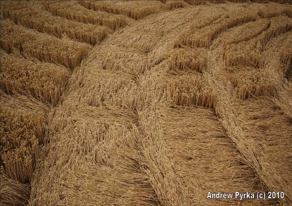
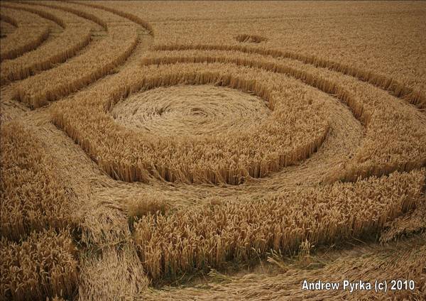
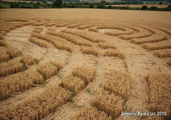
These three show the hidden arc, as well as two location with groups of stems that started laying in the direction of the surface lay, then turned 90 and/or 180 to the flow. Very intriguing.

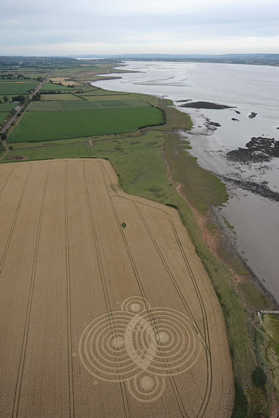
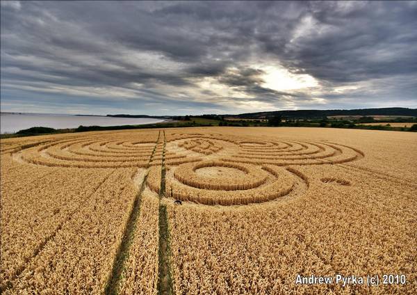
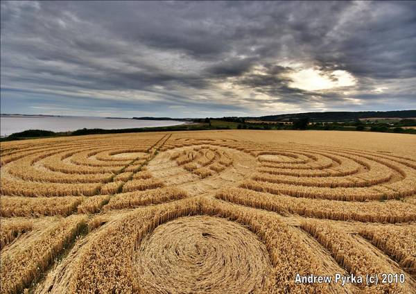
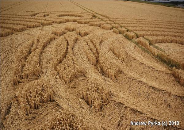
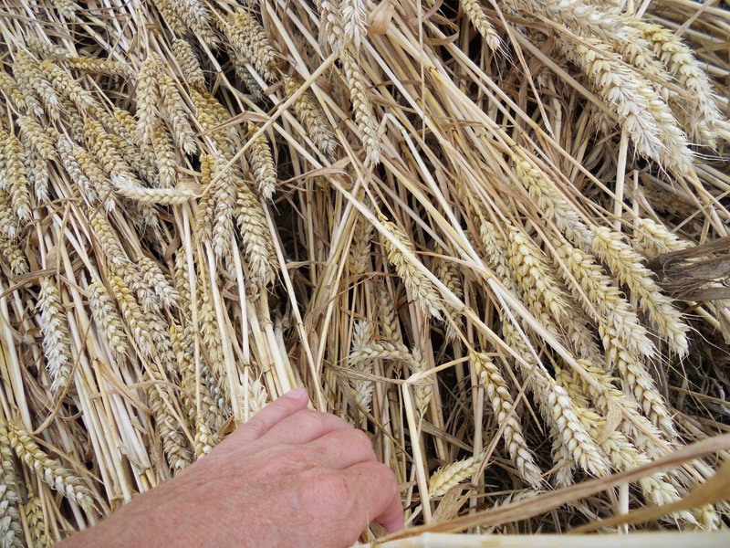
Visited the Woolaston formation today.  Some fascinating elements in the lay and some very palpable energy.  For some reason, not all of my photos would transform into smaller files.  There was a hidden 
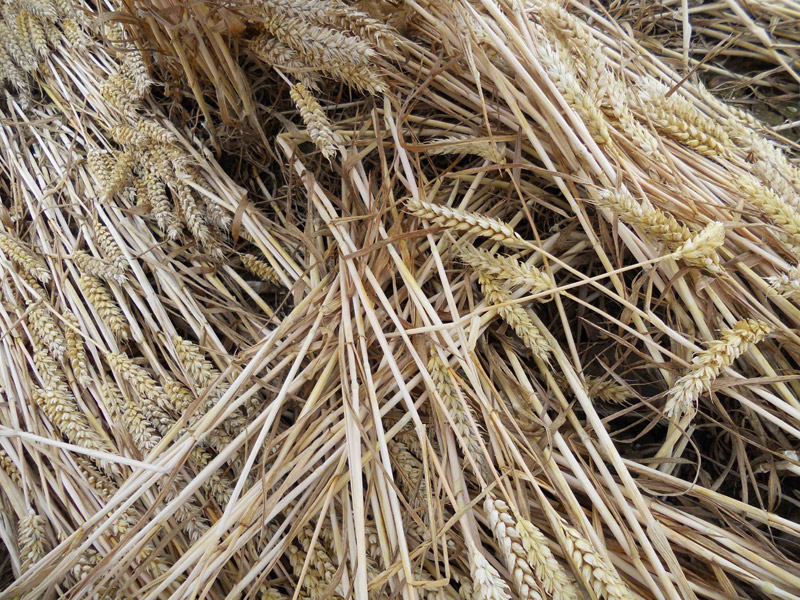
"tracer arc" about 6-8 inches under the surface lay in the opposite direction which completed the outside edge of the first ring around the left side circle.  The right side circle did not have a similar tracer arc, but rather, laid wheat filling in the completion of the first ring around the circle.  Also found a couple of spots where the underlying wheat went with the direction of flow initially, then turned 90 or 180 degrees.  Great formation in a very remote spot.

Ross Holcombe

Images Ross Holcombe Copyright 2010


AERIAL SHOTS GROUND SHOTS DIAGRAMS FIELD REPORTS COMMENTS ARTICLES

BACK

  
Mark Fussell & Stuart Dike