|
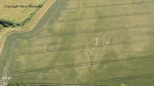
I'd like to report a Crop circle that was mown
out by the farmer within hours of its Creation last June. I saw it
last June close to the village of Kingston Deverill the coordinates
were: 51 07 N 2 13 W (I think). The field is under Rape this
year.
Chris Richardson |

|
FOR VISITING THE CROP
CIRCLES.
|
|
Location: |
Melksham |
| Map: |
9063 |
| Crop: |
Maize |
| Description: |
Circles inside circles |
| Discovery: |
15th September 2009 |
| Name: |
John Banks |
| Status: |
Waiting for second confirmation and
photographic evidence. |
|
Location: |
Woodborough Hill below where owl was
toward road |
| Map: |
|
| Crop: |
Wheat |
| Description: |
Circle in middle 4 same designs on
outer rim of circle |
| Discovery: |
16th August |
| Name: |
Susan Caldicott |
| Status: |
This is a double report of the previous
crop circle of
Tawsmead Copse, West Stowell, Wiltshire. Reported 13th June. |

SOUTH FIELD
Yatesbury Hill, Nr Aerodrome,
Wiltshire.
Reported 6th August.
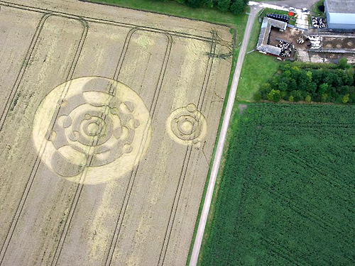
Updated Thursday 27th August 2009
|
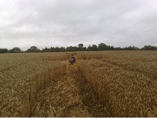

Crop circle in at
Wheaton Aston, South Staffs. Reported 4th August 2009.
Its been quite
hard to take a picture as its quite flat, you can see it from the
Bishops Wood Road going towards the A5 just @!!
Toby Mackay
(The Events Coffee Company)
|
Location: |
Between Wheaton Aston and Bishops Wood
at the back of the A5 by Bradford arms pub Staffordshire |
| Map: |
Google maps |
| Crop: |
wheat |
| Description: |
8 point geometry with large outer ring |
| Discovery: |
4th August 2009 |
| Name: |
Nathan Coates |
| Status: |
Waiting for more pictures. |
|
|
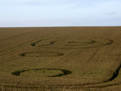
Location: |
Cross Dyke , Nr Pickering, North
Yorkshire.
On the A169 Between Pickering and
Lockton
On the A169 from Pickering Right Hand side on straight piece of road
before the Fox and Rabbit Inn. |
| Map: |
Location |
| Crop: |
Wheat |
| Description: |
Large circle with shape in centre&two
smaller circles below |
| Discovery: |
02/08/09 |
| Name: |
Mrs Leona Attwater-Dunn |
| Status: |
Waiting for second confirmation and
photographic evidence. |
|
I think we have seen
a crop formation in a field today near Tunbridge wells.
It is clear that
there is some sort of unusual activity there – flattened areas where
the crops stand a few centimetres off the ground then bend at the
nodules and there are several sections over a wide area. We can’t
see it clearly from the ground the full sense of the formation but
we can see that is looks very like a crop formation.
The field is large
and slopes down a hill and there are several flatten shapes which
look amazing. There are no obvious entry tracks or paths into the
field.
UPDATE:- Wind
Damage only.
Susie C
Lamberhurst |
|
Location: |
Near Chicklade, south of the A303
(visible from the road although at times passed behind bushes/trees
as we drove eastwards, uphill, with the formation down below to our
right) |
| Map: |
Not known |
| Crop: |
Not known (golden, possibly ripe wheat) |
| Description: |
Looked to be fairly simple, probably
just two adjacent circles |
| Discovery: |
Sunday 19th July 2009 |
| Name: |
Kathryn McCann |
| Status: |
UPDATE:- We (Dorthe
Elisabeth Wennerfeldt and myself) we can also confirm that
there is no formation visible from the A303. Nils Kenneth Fordal |
|
Location: |
Between Wincanton and Bourton,
Somerset, north of the A303 (visible from the road) |
| Map: |
Not known |
| Crop: |
Not known (golden, possibly ripe wheat) |
| Description: |
The design looked fairly complex and
incorporated a star (possibly six-pointed or more). It looked to be
at the bottom right of the field, as viewed from the A303 |
| Discovery: |
Sunday 19th July 2009 |
| Name: |
Kathryn McCann |
| Status: |
Update:- Ross and Meredith
Holcomb went to investigate this circle today and say there is
nothing there but a patch of wind damage. |
Cannings Cross Farm, nr All
Cannings, Wiltshire. Reported 9th July.
SAD, SAD, SAD!
|
From:
Charles Mallett
Date: 07/07/2009
23:54:07
I may have seen a new circle today? Near Clatford.
Driving down to A4 from Manton Farm it was in crop on other side of
A4. South of Lexbury Farm, west of Sunrise Farm. Need eggs? I'll be
over later this week.
Chris |
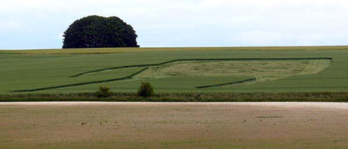
Pewsey White Horse
|
Location: |
Irlam, Greater Manchester |
| Map: |
maps.google.co.uk |
| Crop: |
Barley? |
| Description: |
Spiralling inner pattern with many
smaller circles around it. Discovered while riding my horse this
morning. Very exciting to have a crop circle appear so close to
home. |
| Discovery: |
16/05/09 |
| Name: |
Jenny Ingram |
| Status: |
Waiting for second confirmation and
photographic evidence |
|
Location: |
Holt Wood Estate, nr Reddish,
Manchester |
| Map: |
(Approx) |
| Crop: |
Turnips |
| Description: |
This is a very strange looking crop
circle, overlooking the M60. I thought my kids were pulling my leg
until i saw it. Google found your website, I didn't realise there
was a crop circle connector. |
| Discovery: |
17th may 2009 |
| Name: |
Bernard Pike |
| Status: |
Waiting for second confirmation and
photographic evidence. |
|
Location: |
Histon, nr Cambridge, Cambridgeshire. |
| Map: |
TL 445 635 GB |
| Crop: |
Wheat |
| Description: |
Pweddy :) |
| Discovery: |
8th May |
| Name: |
Pow! |
| Status: |
Waiting for second confirmation and
photographic evidence |
|
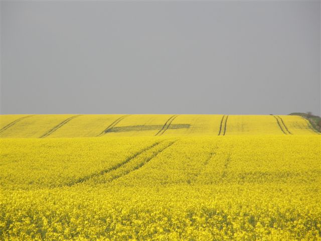
Location: |
Near Wanborough & Liddington A419 off
the A419 towards Wanbourgh |
| Map: |
APPROX |
| Crop: |
Oilseed Rape |
| Description: |
Not sure if what I saw is a circle, but
if it is, it is only just visible from the A419, and looks like a
single disc |
| Discovery: |
7th May and 8 May |
| Name: |
John ???? and Rob Smythe |
| Status: |
Waiting for second confirmation and
photographic evidence |
|
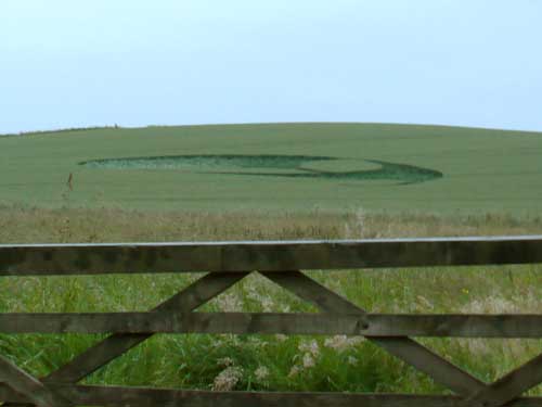
Location: |
Between Alton Barnes & Stanton St
Bernard, Wilts |
| Map: |
|
| Crop: |
Canola |
| Description: |
Approx 140ft diameter, yin and yang
glyph with Celtic knot type band around it |
| Discovery: |
Monday 20th April 2009 13:59:35 |
| Name: |
Matt Wilson |
| Status: |
Waiting for second confirmation and
photographic evidence |
|
Location: |
Alongside the M6 southbound, about 1
mile before junction 19 (Manchester) |
| Map: |
|
| Crop: |
Yellow Flowering Crop (Rape?) |
| Description: |
Our daughter pointed it out as we drove
past. From what I could see, it was a big star with orbiting circles |
| Discovery: |
19th April 2009 |
| Name: |
Carol Braithwaite |
| Status: |
Waiting for second confirmation and
photographic evidence |
|
Location: |
Near Appleton, next to the M56,
Cheshire |
| Map: |
http://maps.google.co.uk/ |
| Crop: |
Rape seed Plants |
| Description: |
Driving westbound, my attention was
drawn to a beautiful flower pattern in a field of rapeseed. Unusual
to see a pattern around here. If I can find the way to the field, I
will try and get a photo from the bridge next to it when I am able
to. |
| Discovery: |
18/04/2009 |
| Name: |
Tommy Gibson |
| Status: |
Waiting for second confirmation and
photographic evidence |
|
Location: |
Handly Cross, nr Blandford, Hampshire |
| Map: |
|
| Crop: |
|
| Description: |
17th April 2009 |
| Discovery: |
I think there is a circle at Handly
Cross on the Salisbury to Blandford road about 600 yards south of
the cross roads, looks like a square to me, did not go in, driving
at the time, but tram lines seem to right through it ok, no longer
flying so cannot verify. |
| Name: |
Busty Taylor |
| Status: |
Waiting for second confirmation and
photographic evidence
UPDATE:-
Drove by today and stopped to take
photos at Hendy cross roads, you can see this when you drive from
Blanford to Salisbury , about 600 yards away from me at the west end
of field, another one to come. Busty Taylor
 |
|
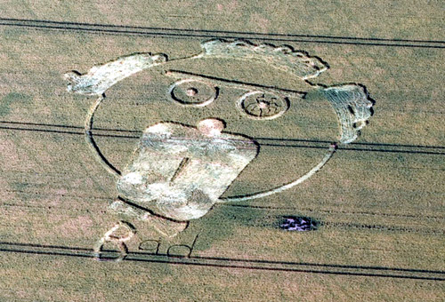
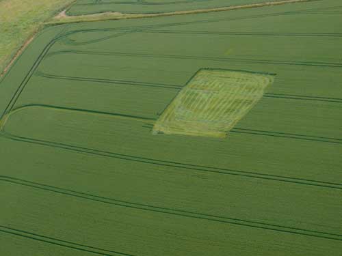
The saga of the plucky West Kennett Avenue crop circle that
wouldn't die seems to have come to an end. The farmer
totally destroyed the formation as shown in the photograph.
He also destroyed a crop circle that
appeared on the north side of Waden Hill in Avebury last
night. Well I cannot think of any other reason he would cut
a square of crop out in the field. Perhaps this still born
could have a spot of remembrance in the rumours section.
With the heavy police presence and the lack of parking, I did
not manage to get a photograph of this one. Why he did it I
don't know, but unless it had been total crap it would have
been a gold mine on this weekend of all weekends.
UPDATE:-
As I said yesterday there was a new formation Saturday
morning on the north side of Waden Hill that was
destroyed by 8am. Attached are before and after photos
of the formation. The before photograph was taken from a
car by a passer. The aerial shows what was left. From
the ground shot it looks very much like a stylised alien
face.
Russell Stannard |
|

