|
|
|
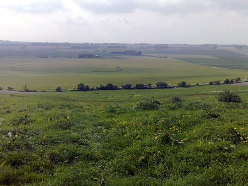
Hackpen Hill, Nr Winterbourne Monkton,
Wiltshire. Reported 24th May.
Map Ref:
Updated Thursday 29th May 2008 |
|
| AERIAL SHOTS |
GROUND SHOTS |
DIAGRAMS |
FIELD REPORTS |
ARTICLES |
Images Nick Nicholson Copyright 2008
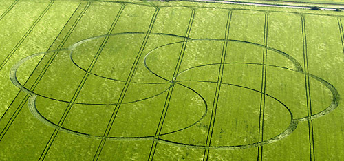
Image Nick Nicholson Copyright 2008
Copyright -
www.temporarytemples.co.uk 2008
http://www.kornkreise-forschung.de
NEW
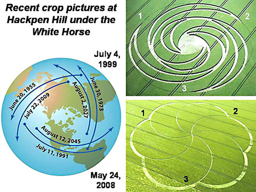
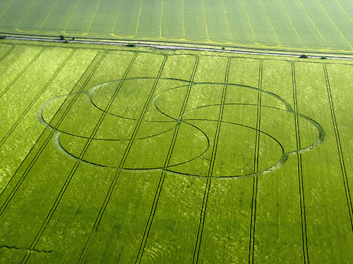
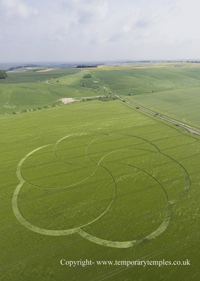
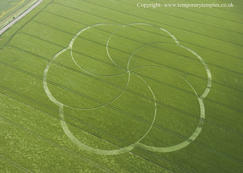
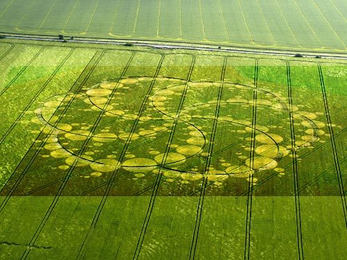
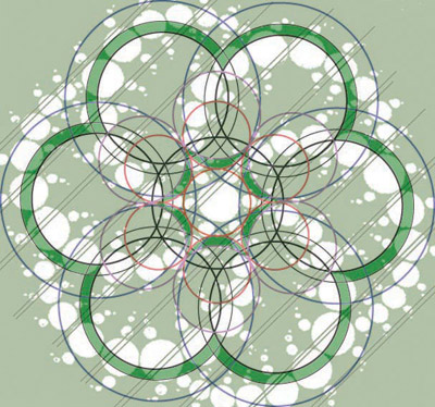
FORMATION AT HACKPEN HILL, NR AVEBURY, WILTSHIRE
This huge formation measured approximately 650ft and whilst a
seemingly simplistic design, is nevertheless a huge formation to be
occurring so early in the season. The design is very similar to the
first circle of the season at Waden Hill a pattern of six
interlocking moons, or crescents, to create a flower shape.
2001 was a pivotal year for the crop circle phenomenon and for the
whole world - I wonder of we are being told something important
here
about the nature of 2008?
Karen Alexander May 2008
|
http://www.cropcircle-archive.com
|
Hackpen
Hill, near Avebury Wiltshire
Reported 24/05/2008
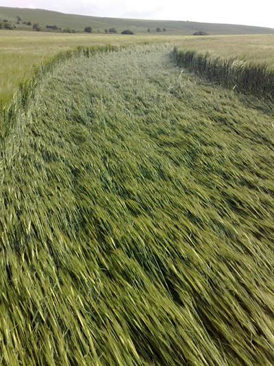
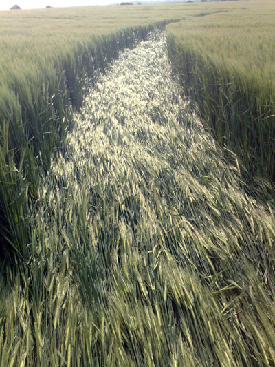
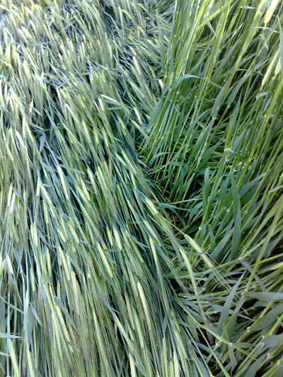
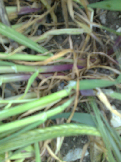
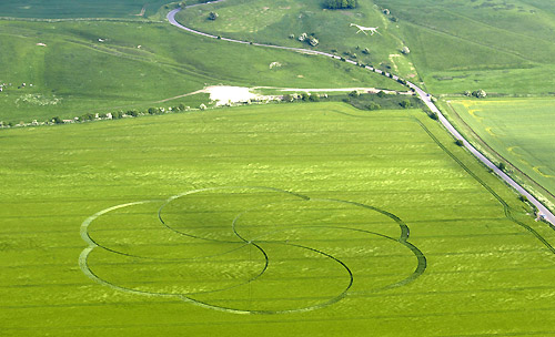
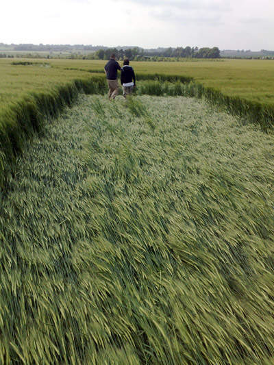
REPORT:
This formation was first
reported in the morning of May 24 2008. The night of 23/24 May was
mostly dry, with a few showers over the region where the circle was
discovered. The glyph can be viewed from the road that runs to the
top of the White Horse at Hackpen Hill.
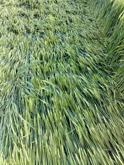
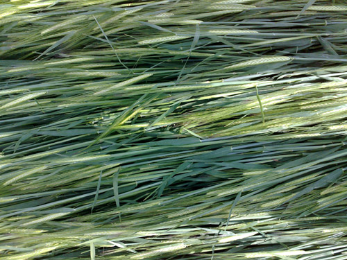
The formation spans
across approximately 620 feet of young barley crop. The laid crop
within the glyph was found to be largely neat and clean, with the
majority of the downed barley neatly bent at the base. Some 40% of
the crop has recovered to its original upright posture and
continuers to grow in an apparently healthy fashion.
The center of the glyph
was noted as being moderately damaged. Given the delicate nature of
these young plants, and also the spindly design of the circle, the
damage found within the circle was considered consistent with the
activities of at least a half dozen previous visitors.
Where the tram-lines
intersect the glyph thick curtains of standing crop remain perfectly
in tact, as if completely untouched by whatever created the circle.
Charles Mallett
Click on Thumbnails to enlarge
Images Charles Mallett Copyright 2008 |
|
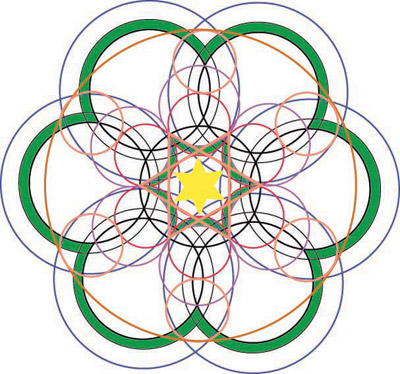
This circle also bears a relationship to the
Milk Hill formation of 2001 - another gigantic crop circle - as
this pattern seems almost like the skeleton or bones of the Milk
Hill formation. Flesh it out - by adding many small circles
along the lines of this new circle and you have in essence the
design of the Milk Hill formation.
Peter Sorensen.
|
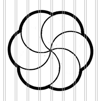
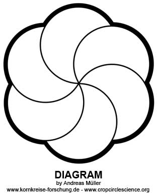
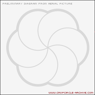
Diagram
Tommy Borms Copyright 2008
Image
Mark Aldridge Copyright 2008
|
Location: |
Hackpen Hill |
| Map: |
|
| Crop: |
Barley (?) |
| Description: |
Six interlocking 'swirls' (similar to
Waden Hill)
Saw this crop circle for the first time approx an hour ago below the
white horse at Hackpen Hill. another series of six interlocking
'swirls', this time (I think) in Barley, |
| Discovery: |
24/05/08 13:40:28 |
| Name: |
Jane & Mark Aldridge |
| Status: |
Waiting for aerial shot and field
report |
|
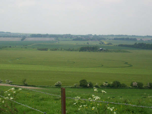
Hackpen
Hill, Nr Winterbourne Monkton, Wiltshire. Reported 24th May.

Of numerous crop circles were constructs on this
model of the flower of life. Here we shall notice that drawings make
fewer and fewer damages in fields, for images just as much
symbolism.
Umberto Molinaro
http://cerclesdanslanuit.free.fr |
|
I was viewing the
latest offering from your Crop Circle Connector newsletter,
“Hackpen
Hill, Nr Winterbourne Monkton, Wiltshire. Reported 24th May.” You
noted in the article accompanying the pictures that it was near a
White Horse formation. I decided to locate and view this particular
geoglyph using Google Maps, to get some idea of the terrain around
the formation…just curiosity, mind you. A previous search for
information about White Horse designs had revealed that the Hackpen
Hill formation was at
+51° 28' 20.94", -1° 49' 3.26". When I
punched in the coordinates for this map, here’s what I found:
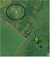
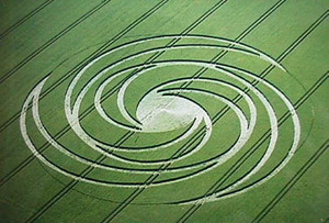
Hackpen Hill, nr Broad Hinton, Wiltshire. Reported 4th July.
Apparently, Google had
captured another crop circle here at some point in time, in
virtually the same spot.
Zooming in reveals it to
be quite an extraordinary formation as well:
Gregory
Annen |
Trans-dimensional Communication Tale 24/05/08 Crop Circle
| AERIAL SHOTS |
GROUND SHOTS |
DIAGRAMS |
FIELD REPORTS |
ARTICLES |
|
|

BACK |

Mark Fussell & Stuart Dike |
|
 |