|
|
|
Church Road, nr Barton-Le-Clay, Bedfordshire. Reported 11th
June.
(2 Formations)
Map Ref: TL086300
This Page
has been accessed

Updated Tuesday 19th June 2007 |
|
| AERIAL SHOTS |
GROUND SHOTS |
DIAGRAMS |
FIELD REPORTS |

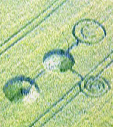
Image Russell Stannard Copyright 2007
|
Here are some
shots of the two formations that have already been reported at
Church Lane, Barton-le-Clay. I did not go in either of them as the
weather was not that good. I will not be able to provide aerial
shots of the formations. I think the hill shots show enough anyway.
Russell Stannard |
|

Make a donation to keep the
web site alive... Thank you |
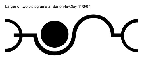
Diagram Paul Howard
Copyright 2007
|

FOR VISITING THE CROP
CIRCLES.
|
I came across this formation today
(Monday 11th June) and discovered it was maybe only a day old, I
thought it worth reporting. The Pictogram is in a single field of
wheat overlooked by the Barton Hills as indicated by the map
reference above.
A real plus is that it is easily seen and
therefore photographed from the vantage point of a public
footpath on the hills above which practically surround the
field in a horseshoe fashion.
My partner and I went down into the field
following the tractor marks and managed to enter the larger of
the two formations as indicated in the enclosed diagram. Oddly
enough though, whilst remembering the design of that one
pretty well, neither of us can recall the pattern of the smaller
formation to the left which on the ground had proved too difficult
to access without potentially disturbing the crop. I'm
pretty pleased that we managed to enter and exit the
larger pictogram without causing any damage, as it was
my first real-life encounter with this phenomenon.
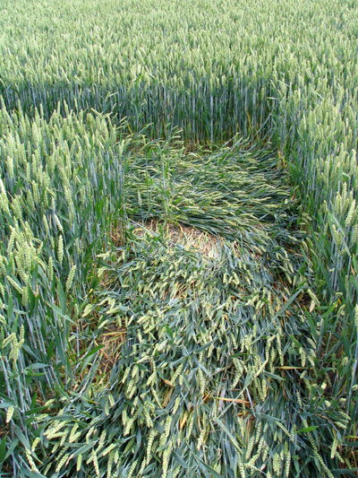
Having witnessed it close up, the lay
appeared very gentle and in perhaps one metre strips. The
'cookie-cut' around the edges was very clean and there
appeared to be no visible access tracks or disturbance around the
formation. The crop appeared undamaged and not bent as such,
but actually growing from ground level at an acute
angle. Interestingly some individual stalks within a
swathe of laid crop would remain upright as if completely untouched
by the gentle force that had laid all the others around it. It
has to be said mind, that on walking the shape we did find two
lengths of red rope of washing-line thickness within the lay
and a crushed empty packet of Lambert & Butler
Cigarettes on the ground in a nearby tractor lane. All of which
we left in situ. Nonetheless, it is an intriguing
pictogram formation and I feel privileged to have witnessed it
so relatively untouched and 'clean'.
Resuming our walk of the surrounding hills
overlooking the design we talked to a chap who turned
out to be the local volunteer ranger for the hills (which is a
wildlife area) and he told us that the smaller pictogram had
appeared perhaps four days ago whilst the larger one was only a day
old. My diagram is only a rough interpretation from memory as
I didn't have a camera with me, and they're quite
difficult to draw, let alone make 80 metres or so wide
in a field in darkness! The smaller design which would be to the
left I have left out, simply because I can't picture it
in my head though I recall it to be comprised of three
small circles that were linked. I hope this info helps
yourselves or whoever you know locally who might want to make a
record of this site...
Paul Howard |
|

Image Russell Stannard Copyright 2007

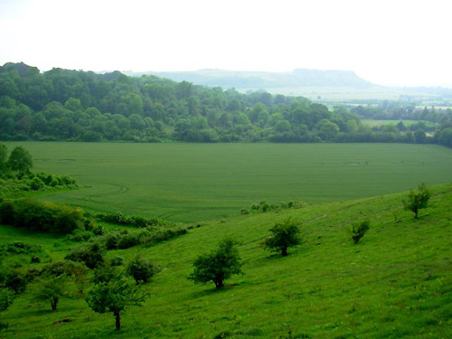
Image Russell Stannard Copyright 2007


Stretched images by Chris Watts
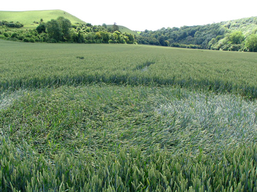
Image William Betts Copyright 2007
Here are some ground shots I took in the
Barton-le-clay crop circle yesterday morning. They were taken in
the larger of the 2 formations.
William Betts
|

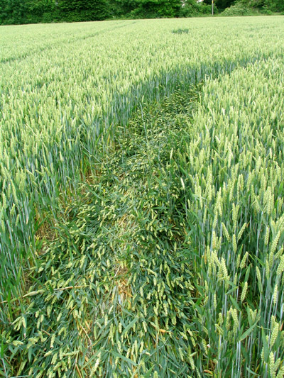
Image William Betts Copyright 2007
|
|
 |