|
|
|
Watton
Road, Knebworth, Hertfordshire. Reported 19th June.
Map Ref:
This Page
has been accessed

Updated Monday 10th July 2006 |
|
| AERIAL SHOTS |
GROUND SHOTS |
DIAGRAMS |
FIELD REPORTS |
Stretched Image Tommy Borms
Images Tony Nash Copyright 2006
| Location: |
Knebworth Hertfordshire Off Watton road (country Lane) |
| Map: |
not
known |
| Crop: |
corn |
| Description: |
various
circles etc |
| Discovery: |
19 06 06 |
| Name: |
?????? |
| Status: |
Waiting for
aerial picture |
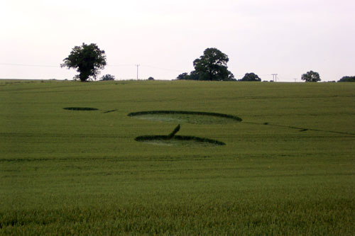
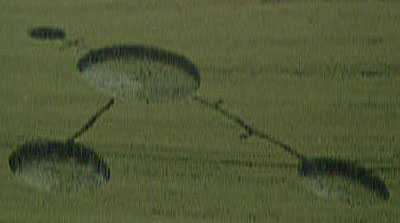
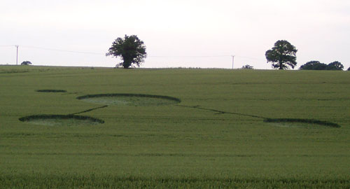
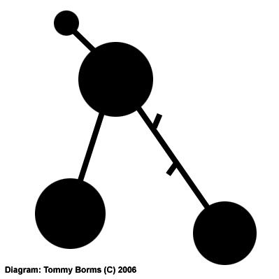
| Location: |
Watton
Road,Knebworth, Hertfordshire |
| Map: |
|
| Crop: |
Wheat |
| Description: |
1 large
circle with 2 slightly smaller circles below it and a smaller one
connected at the top of the formation |
| Discovery: |
June 2006 |
| Name: |
Tony
Nash |
| Status: |
Waiting for aerial picture |
|
|
 |
