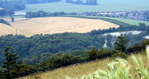
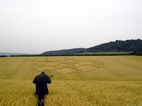
Kent has another
superb crop circle that in keeping with many of our local events over
the past few years, has again arrived in daylight! It lies next to The
Pilgrims Way & can be easily seen from the Blue Bell Hill Picnic Area.
This beautiful formation that has a lot in common with many of the
designs that arrive locally, is laid out in barley that's just turned
to gold. This golden event appeared yesterday evening (June 24th) at
sometime after 8.0 pm according to some reliable sources (I was there
at 7.30 pm and there was no sign of it then!). This field previously
received a crop circle on 14th July 2004, but on that occasion it
appeared in the opposite corner. We have learnt that the farmer is
not best pleased...do not enter unless you have his
permission.
G.Tucker
UPDATE
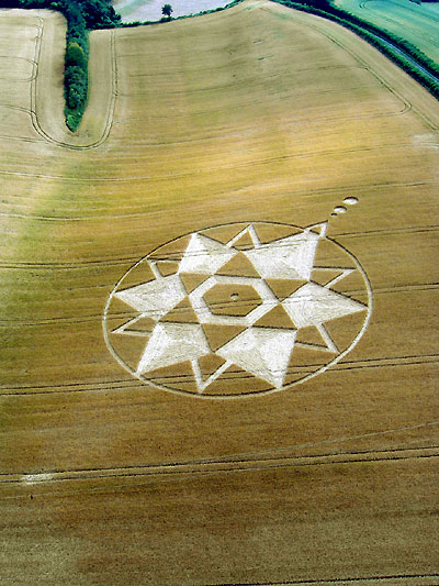
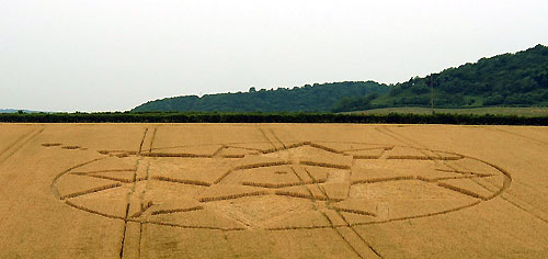
This formation that likely appeared late evening on the 24/6/06 has
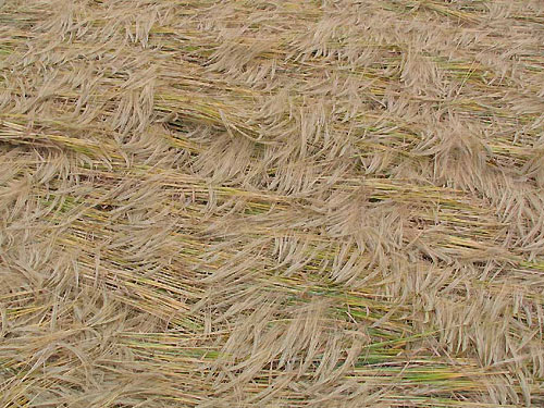
aroused much interest. Laid in barley which often presents us with an
exquisite floor lay, it certainly didn't let us down! Whilst there
really was nothing to speak of in the way of centrepieces or the like,
it generally flowed beautifully. Viewed obliquely you were often
reminded of shallow waves complete with sea horses!...But when you
looked straight down on it in some areas, you were confronted by a
lightly feathered weave, further enhanced by the "fluffiness" that can
only be seen in barley.
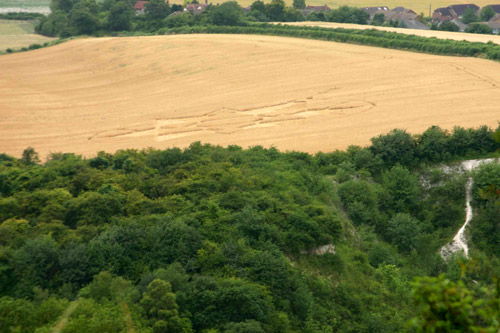
The formation from the air does look a bit at odds with itself. But
according to Andy Fowlds :- "The formation at Burham is positioned
on a fairly steep slope - I think the reason for the quirky geometry
is because of the METHOD of transmission and how that can be affected
by the natural contours of the land. It almost looks like the design
has been "stretched". This isn't the first formation we have seen
formed like this and I doubt it will be the last."
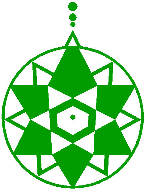
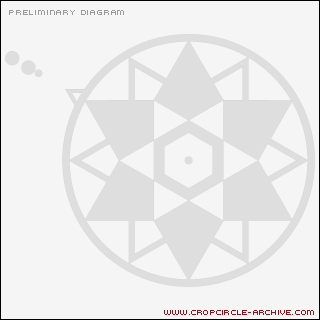
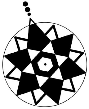
Something also of interest is the triangle and small satellite circles
that are outside the formation at top left. Could it be that the
triangle is in fact an arrow pointing to circles...separate crop
circles? Well according to my calculations that I've gone over several
times, the star is pointing due west. Which means it's heading for the
position of the "Burham Starburst" of 2003 which was only a field or
so away. Compared to some of our past events, the "Burham Starburst"
was quite a small formation...just like the one that's first pointed
to by the arrow. But there's more...If you carry on with this
alignment it crosses the River Medway a mile or so away running past
Snodland Church, where it then heads directly for the much larger
"Holly Hill" formation of '98. So where's the third...is that yet to
appear?
Obviously this all needs to be checked out more thoroughly but I
wouldn't mind betting I'm not far out. What's also interesting is that
along with this new formation the two I've mentioned here are also
six-folds that reference a "Star of David".
(
Diagram Tommy Borms Copyright 2006
So many of our Medway
events over the years have been laid within spitting distance of Blue
Bell Hill and this one's no exception. This particular hill which is
the highest easterly point of the North Downs is famed for its Sarsen
stones. In fact it was probably the main supplier for all our local
stones that appear on the valley floor below. What's little known is
that there once was an ancient track that led from the summit that
managed to wind its way all the way down. Near towards this top end of
this track there was an impressive avenue of Sarsens on either side
which led to a stone circle. This old track has now become a
residential access road known as Warren Rd, which as an
alternative plunges you into superb ancient woodland rather than the
motor-mad mayhem of the A229.
G.Tucker