|
Code: SUSSEX 2005/01
Location: EARWIG HILL, RINGMER, NR LEWES, EAST SUSSEX
First reported: 23 April 2005
Crop: Oilseed rape (Canola)
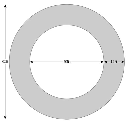
Design: Ring
Dimensions: 82ft total diameter
Surveyed by: ALLAN BROWN, ANDY THOMAS & JORDAN THOMAS, 24 April 2005
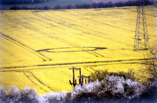
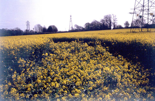
REPORT: This formation, only the third to be
reported in the UK this year, is south of the B2192 road from Lewes to
Ringmer, near Malling Down, in the same field as a small pictogram in
wheat last year. It can be seen from the road by alert drivers, though
it is not immediately obvious, and appears to sit between two
pylons. A much better view can be had from Malling Down itself.

A simple clockwise-laid ring (not circle, as some
have reported) of 82ft overall diameter, with a path of 14ft average
width, the crop was neatly laid and in a generally good condition on
inspection, with largely unbroken and unscuffed stems. Some breakage
was observable in places (though largely individual leaves rather than
the main stems), but the majority appeared undamaged and crop recovery
was already becoming apparent. It was interesting to observe how much
mud and damage was applied to the plants when walking on them for
surveying purposes, yet there was no evidence of this when we first
entered.
The centre of the ring is deep into standing
unaffected crop. There was a small space which might possibly have
served as a geometric centre, and an intimation that crop might have
been moved aside for someone to access it or at least seek it out
before us, but otherwise there was no very obvious path to it.
Overall, the formation was pleasing in its
simplicity and it marks a return to early season Sussex crop circles,
after a few years where we have had to wait until May-June.
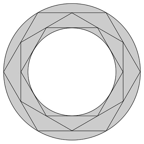
A separate report on the geometry of this formation,
by Allan Brown, follows below.
Report by ANDY THOMAS, 25 April 2005
Photos by Andy Thomas, diagrams by Allan Brown
Southern Circular Research
|