We apologize for possible errors in the
translation (made by google translator).
We have received several reports in preparation of a case of
crop circles occurred at Umbertide. Among these is that of
Andrew, who (thank him) also sent us the images (see below)
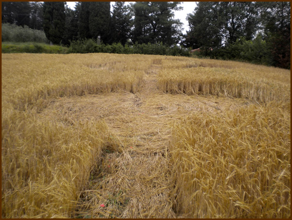 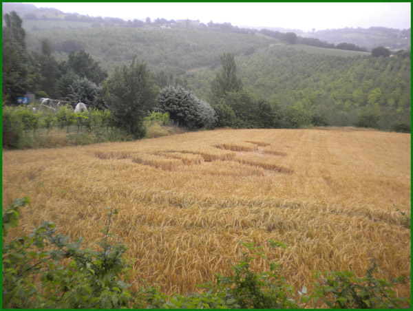

This is a wheat field located in St. Benedict, about 3 km from
Umbertide (Perugia). The design (although not enthusiasm for
size and clarity of the profiles) seems to represent a kind of
key rings or circles and connected by a central axis. Presumably
dating from 20 to 21 June. We await further information and
aerial photography, and we will update soon.

|
