CROP CIRCLES IN CANADA IN 2007 07 Formations |
Updated Tuesday 30th October 2007
|
Quill lake, Saskatchewan - early
September, 2007 Location Date: early September, 2007 |
|
Londesborough, Ontario - October 1, 2007
Location (nearest town or landmark): Londesboro, Ontario |
|
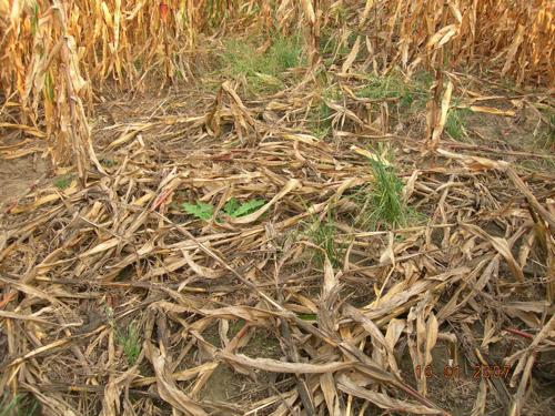
Shakespeare, Ontario - mid-late August, 2007
Location
(nearest town or landmark): Shakespeare, Ontario
|
|
Abbotsford, British Columbia #2 - August 26, 2007
A second formation in the Abbotsford, British Columbia area
found on August 26, not far from the first Greenpeace
formation. A sort of ‘stingray’ type shape, in cattle corn,
approximately 21 metres (70 feet) long (initial estimate
from aerial photos). Irregular geometry and placement in
field make it a probable hoax, after media coverage of the
Greenpeace formation. Still under investigation by CCCRN
British Columbia, further details pending...
Image Laurel Konrad (CCCRN British Columbia) Copyright 2007 Location (nearest town or landmark): Abbotsford, British Columbia
Date First Reported or Discovered: August 26,
2007
Description: ‘stingray’ type shape
Crop / Vegetation: corn
Size: approximately 21 metres (70 feet) long
(estimate)
Farmer: unknown
Investigation: CCCRN British Columbia
Source / Credit: Laurel Konrad (CCCRN British
Columbia)
Notes:
Found by Laurel Konrad (CCCRN British Columbia)
while flying to view first
Greenpeace
formation. Approximately 1.6 kilometres (1 mile) from Greenpeace
formation. Irregular geometry and placement in field make it a
probable hoax, after media coverage of the Greenpeace formation.
|
|
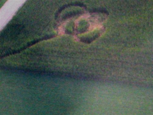
St. Gregor, Saskatchewan - August 26, 2007 CROP CIRCLE FORMATION REPORT - ST. GREGOR,
SASKATCHEWAN
© Beata Van Berkom (CCCRN Saskatchewan) Location (nearest town or landmark): St.
Gregor, Saskatchewan
© Beata Van Berkom (CCCRN Saskatchewan)
© Beata Van Berkom (CCCRN Saskatchewan)
© Beata Van Berkom (CCCRN Saskatchewan) Check out these videos I made in the new St Gregor SK crop circle.
http://exposure.cbc.ca/video/saskatchewan-crop-circle Beata Van Berkom |
|
Rosedale, British Columbia #2 - July 24, 2007
Images © Joe & Carolyn Ditto Copyright 2007
Location (nearest town or landmark): Rosedale, British Columbia
(east of Chilliwack)
Date First Reported or Discovered: July 24, 2007
Description: long tapering ‘rectangle’
Crop / Vegetation: cattle corn
Size: approximately 30 metres (100 feet) long
Farmer: confidential
Investigation: CCCRN British Columbia
Source / Credit: Joe & Carolyn Ditto
Notes:
Formation in three ‘sections’ of differently flattened plants;
largest section, starting at the north end, is rectangular with
plants flattened primarily all in one direction lengthways,
tapering toward the less organized sections at the narrower
south end. Many ‘cuts’ in stalk nodes, as with previous
formations in cattle corn in this region. Possibly lodging /
wind damage, although the geometry, while a bit rough in spots
(partly due to the plants coming back up again because of
phototropism), looks a bit too regular than usual for that. In
separate field from first formation.
|
|
Rosedale, British Columbia - July 24, 2007
© Laurel Konrad (CCCRN British Columbia) Location (nearest town or landmark): Rosedale, British Columbia (east of Chilliwack)Date First Reported or Discovered: July 24, 2007 Description: small rectangle Crop / Vegetation: cattle corn Size: approximately 7.6 metres (25 feet) long Farmer: confidential Investigation: CCCRN British Columbia Source / Credit: Joe & Carolyn Ditto Notes: Plants flattened primarily all in one direction. Many ‘expulsion cavities’ and ‘cuts’ in stalk nodes, as with previous formations in cattle corn in this region. Possibly lodging / wind damage, although the geometry, while a bit rough in spots (partly due to the plants coming back up again because of phototropism), looks a bit too regular than usual for that. |
All reports from...