West Wick, nr Oare, Wiltshire. Reported 6th August.

Map Ref: MAP


Updated Thursday 7th August  2008


AERIAL SHOTS GROUND SHOTS DIAGRAMS FIELD REPORTS ARTICLES


Images Frank Laumen Copyright 2008


Location: 
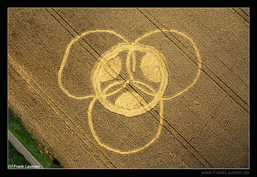
Next to canal about a mile from Pewsey.Near Sunny Hill & canal, near Pewsey, Wiltshire
Map:  
Crop: Corn
Description: Is small & consists of 3 circles meeting in a centre circle. Can not be seen from the roads. Small formation with a centre circle & 3 outer circles linking in middle
Discovery: 6th Aug
Name:  
Status: Waiting for photographic evidence

COMMENTS


AERIAL SHOTS GROUND SHOTS DIAGRAMS FIELD REPORTS ARTICLES

BACK

  
Mark Fussell & Stuart Dike