|
|
|
Cherhill (2), nr Calne, Wiltshire. Reported 12th
August.
Map Ref:
Updated Friday 15th August 2008 |
|
| AERIAL SHOTS |
GROUND SHOTS |
DIAGRAMS |
FIELD REPORTS |
ARTICLES |

Click on Thumbnails to enlarge
Images
Janet Ossebaard
Copyright
2007

Images
Janet Ossebaard
Copyright
2007
|
Location: |
Cherhill bottom left, below Cherhill
formation of 07/8/08 not visible from roadside. |
|
Map: |
|
|
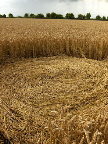
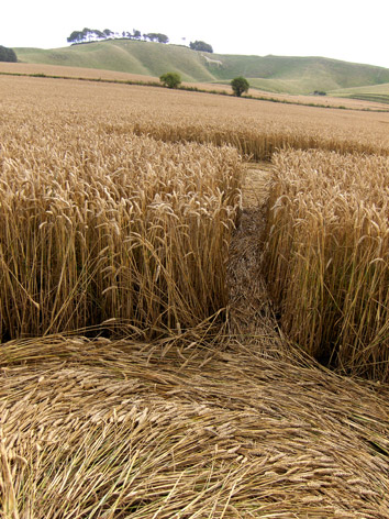
Crop: |
wheat |
|
Description: |
3 similar sized flattened and
swirled circles. flowing anti-clockwise, and one smaller clockwise
circle form a square/diamond shape, linked by straight flattened
lines |
|
Discovery: |
I went in this also on 12/08/08 |
|
Name: |
Jic Jane |
|
Status: |
Waiting for photographic evidence |
|
 |