|
|
|
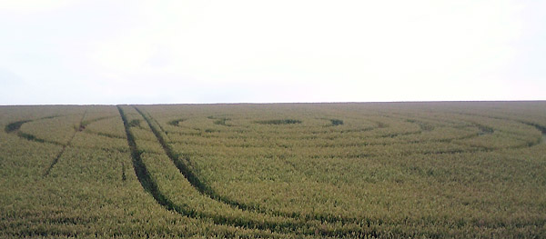
High Kingthorpe, nr Pickering, North Yorkshire. Reported 29th July.
Map Ref: MAP
Updated Tuesday 12th August 2008 |
|
| AERIAL SHOTS |
GROUND SHOTS |
DIAGRAMS |
FIELD REPORTS |
ARTICLES |
Images Win Keech Copyright 2008
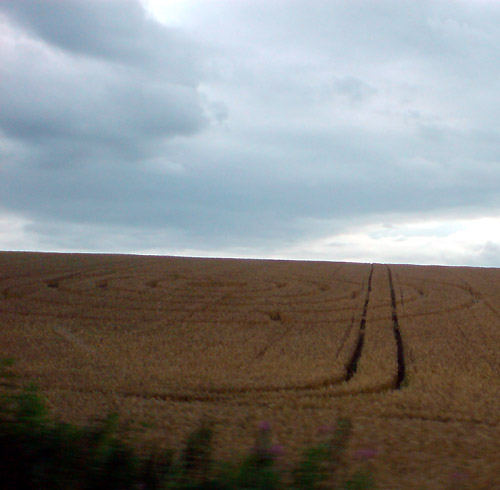
Image Ed Banks Copyright 2008
|
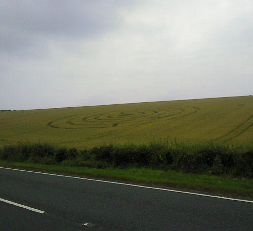
So I was driving over towards the coast today and
saw a crop circle in a field! I managed to get a quick picture,
which I have attached. It's hardly the best picture, and it seems a
pretty uninspiring circle, but it's better than nothing! It was
located about 5 miles or so east of Pickering in North Yorkshire.
Ed Banks |
|
Location: |
A169, 5 miles from Pickering, North
Yorkshire |
|
Map: |
|
|
Crop: |
Wheat |
|
Description: |
A simple set of concentric rings with
linear insets - appears mechanically flattened. Is next to the main
Pickering to Whitby A169 near the Fox and Rabbit Inn on the N.
Yorks. Moors. ...
a bit off the beaten track, so might be of interest to you. Both
images taken on my mobile from the side of the A169 near the fox and
rabbit inn |
|
Discovery: |
29/07/2008 |
|
Name: |
Win Keech |
|
Status: |
Waiting for aerial and field report |
|
 |
