|

Diagram Bertold Zugelder Copyright 2004
www.cropcircle-archive.com
|
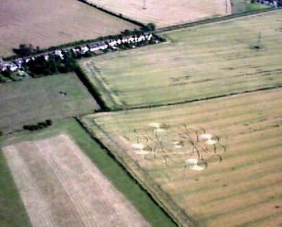
Image Andrew King Copyright 2005
 |
Garsington, Oxfordshire. Reported 15th July.
HI, I have been trying to report a
circle in Oxfordshire and as yet it has not been posted on your
site, I don't think it is the same as the one posted on the 11th
as I drive this route everyday to work and only noticed it
yesterday. I've attached 2 photos I took, please let me know if it
is the same circle or not. many thanks.
David Schwartzman
Well I've visited the Cuxham/Chalgrove
circle, and can confirm it isn't the same one as that in the new
picture.

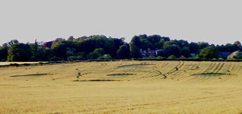
Pic 1 shows the formation from the bottom of the field.
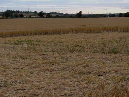
Pic 3 shows the southern-most large circle.
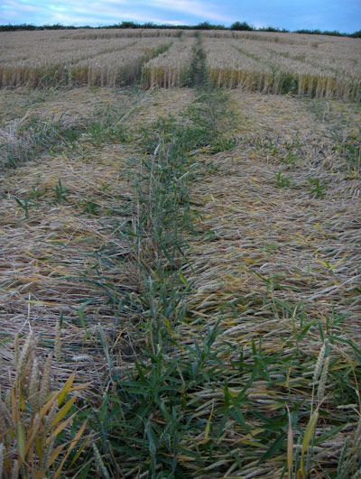
Pic 2 shows the lay in the central circle, including rows of standing weeds.
I've attached
some ground shots of the first formation; I didn't get many
good ones, as the light wasn't very conducive. The lay had
some nice swirls, though there were an awful lot of stems
broken a centimetre or two above the base.
Darren Francis
|
|
Location: |
Tootbaldon, Oxfordshire |
|
Map: |
|
|
Crop: |
Wheat |
|
Description: |
Extremely complex formation, with numerous intersecting arcs. At
least 500 feet across |
|
Discovery: |
14/7/05 |
|
Name: |
David Schwartzman |
|
Status: |
|
| Location: |
Garsington, Oxfordshire |
| Map: |
x458500,y201500 |
| Crop: |
Wheat |
| Description: |
Very
large complex circle, on hill below Garsington |
| Discovery: |
14/7/05 |
| Name: |
Tudor
Georgescu |
| Status: |
Waiting
for aerial image and field report. |
|
|


