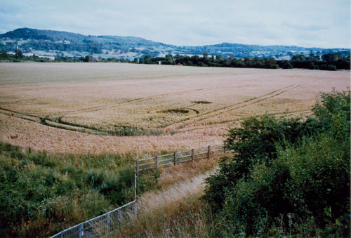
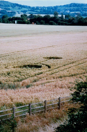
Brockworth, nr Gloucester, Gloucestershire. Reported 16th July.

Map Ref: SO898174 Very Approx

Updated Wednesday 28th July  2004

Hit Counter


Images  Leyton Cook Copyright 2004

3 photographs taken at Junction 11a of the M5 Motorway, Brockworth, Gloucester. 

These pictures were taken from the motorway embankment on 17th July 2004 at 19:00 approx. The crop was already recovering at the time the pictures were taken so possibly could have been laid down early July.


Location: Junction 11a M5 Brockworth Glos
Map:  
Crop: wheat
Description: 5m circle with .5m concentric ring connected to 3m circle by 5m x 1m strip
Discovery:

16/07/04

Name: L Cook
Status: .Waitinjg for aerial shot.

BACK

  
Mark Fussell & Stuart Dike