I visited the crop circle at Rudston over the
weekend these are the best photographs i could get as the circle is
situated high on an hillside.
From a distance the formation looks quite complex and pretty big but on
closer inspection it is poorly laid and messy with most of the crop
recovering. I also noticed that it looked to be a lot older than the
discovery date suggests however the farmer who was in the field at the
time confirmed the discovery date as July 9th. He said that the circle
wasn't there on Tuesday evening (8th July) but was there for all to see
at 7:10 am Wednesday (9th July). He was under the impression that
people had made the circle and wouldn't entertain any other theories.
He also added that he had not contacted the local press as he didn't
want to encourage the perpetrators.
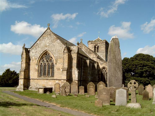
The village of Rudston is said to be the oldest
village in England with settlements dating back to prehistoric times.
The tallest standing stone in England (26 ft high) is situated in the
local church yard. The crop circle can be seen from the megalith
location and all around the Rudston village area.