|
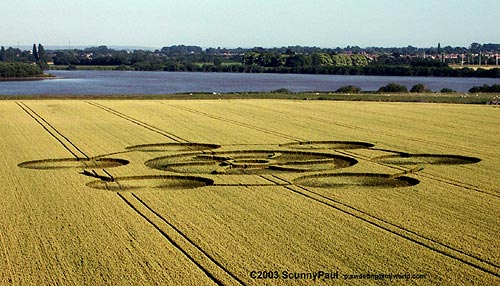
Image Scunny Paul Copyright 2003
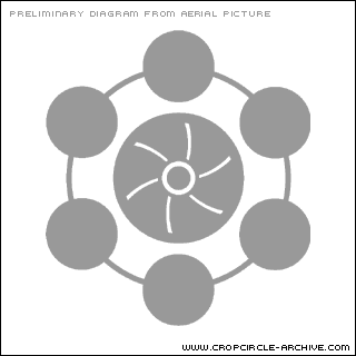
Diagram Bertold Zugelder Copyright 2003
http://www.cropcircle-archive.com
| Location: |
M62 westbound junction 37 below river Ouse bridge |
| Map: |
SE 748266 |
| Crop: |
Wheat |
| Description: |
One large circle (50 ft) spoke effect in centre,
with six linked circles (20 ft) around the large one. Email me for
photo |
| Discovery: |
9 July 2003 |
| Name: |
Paul |
| Location: |
The River Ouse bridge in the field on the left (the
bridge is on the motorway), heading west on M62 motorway ,Yorkshire
(near Goole ) UK |
| Map: |
|
| Crop: |
|
| Description: |
Round with smaller circles within and other curves
etc |
| Discovery: |
10/07/03 |
| Name: |
Dawn Banton |
| Location: |
To LHS and below of M62 bridge between J37 & J36 nr
Goole |
| Map: |
SE 743261 |
| Crop: |
Barley (?) |
| Description: |
Petals I think - was driving |
| Discovery: |
11/07/03 |
| Name: |
Deborah Russell |
| Location: |
M62 westbound junction 37 below river Ouse bridge |
| Map: |
|
| Crop: |
Wheat |
| Description: |
6 BIG linked circles surrounding a sort of wheel
type of thing. the whole thing is about 260ft diameter |
| Discovery: |
9th of July 2003 |
| Name: |
Stewart Littlehampton |
|
