|

Images Andrew King Copyright 2003
The Crop Circle Connector would like to thank Andrew for the image.
Images & Diagram
Graham Tucker
Copyright 2003
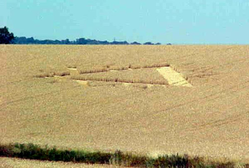
12 July 2003 - Burham, Kent
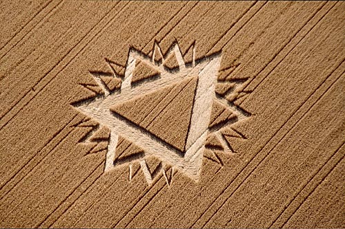
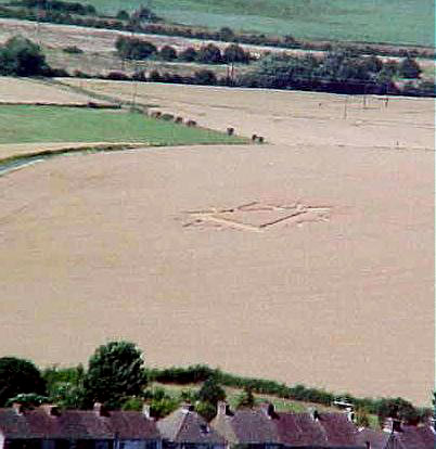
This triangular formation arrived on the 12th
July, just outside Burham village, which lies within the Medway Valley
between Rochester and Maidstone (OS grid ref TQ726618).
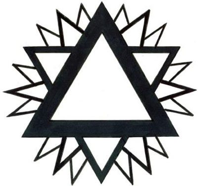
Basically it's a six-fold "Star of David"
design with additions that are possibly fractal. It's in ripened wheat and
is approximately 70 feet across ... we say approximately because the farmer
refused us permission to enter the formation. This also means that the
accompanying rough sketch of the pattern may not be totally correct, for
although the formation is placed on a slope, it's at an oblique angle, so an
aerial photo might easily prove us wrong!
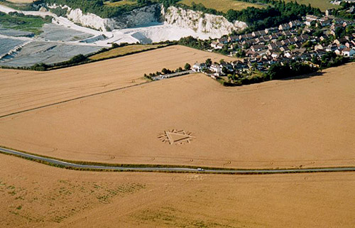
The formation lies within 300 yards of the old
pilgrim's track - "The Pilgrims Way", but what is more interesting is the
fact that its precise position in the field helps to form a 5 mile alignment
that includes the exact locations of two previous formations (Holly Hill,
Birling '98 and Bluebell Hill 2001).
Graham Tucker

Diagram Bertold Zugelder Copyright 2003
http://www.cropcircle-archive.com
|
