|
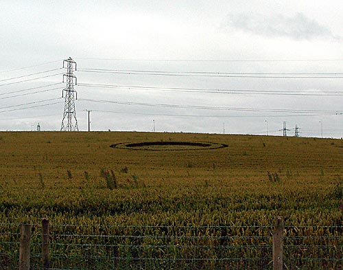
I've taken a photo with a digital camera, apologies for the quality, it
is some distance from the path and unfortunately there isn't an elevated
position to view it from. I don't know if I mentioned in my last email,
but in the main circle there is a tall plant growing about 4.5 feet
high. All the corn around it is completely flattened though the plant is
unaffected - as though it grew after the formation was made. Talking to
other people, it would seem it appeared on Monday/Tuesday of this week.
Report by
Adam Giddins |
|
Location: Lea, Preston,
Lancashire.
Map:
SD485303
Crop: Wheat
Description: One large circle surrounded by a
concentric 'path-type' circle
Discovery: 23-7-02
Name: Howard Clinton
I've just found your site on the web
and thought you'd like to know about something I saw this
morning. I live in the Preston area and this morning I was
out
for a run along the new Millennium Link between the
Lancaster Canal and the River Ribble. As I approached
Blackpool Road (at Lea) I noticed what I think is a crop
circle on the hillside to the left. At a guess I would say
it was about 70-80 ft across and was a single circle
surrounded by another path-like circle. I don't know
whether it is a bona fide crop circle or just something to
do with tractors in the field or something, but I thought
I'd let you know.
Adam Giddins |