|
Situated so that the best viewing position is the Northern slip road of
J56 A1M. A roman road known as Dere Street and continuing as the B6275
passes behind the field in which the formation is located, also behind
this field is the hamlet of Low Hangbank. It is a prominent and clear
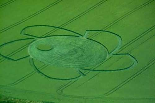
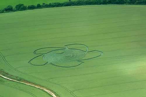
cut pattern in immature green wheat. Although no aerial images are
available I have stretched an image to reveal its design.--- It is a
laid circle with a round island of standing stems in its south western
flank. From the perimeter of the main circle spring five curving shapes
these terminate in a short straight path back to the perimeter, a short
space follows and the next curving shape commences and so on around the
design. In short it looks like a circular cutter.
Report by
Nick Nicholson
|