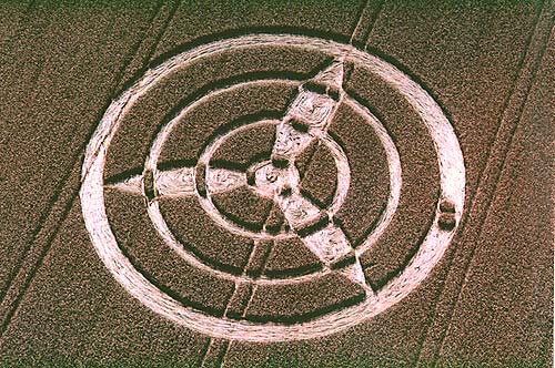
I'm writing to inform you of a new crop circle formation
which appeared
over the weekend. The circle is in Rye and is
visible on the left hand side of the A272 just before you
enter Rogate coming from Petersfield direction (OS grid
ref SU803245). It is a couple of fields back from
the road and is about 170 ft across. It appears to be a
complex three pointed formation with multiple rings.
Reported by Richard Harrison
Location: Rogate, West
Sussex
Map:
SU803245
Crop: Barley (I think)
Description: I thought you might be interested in
knowing that I discovered a crop circle while out at the
weekend. The circle is just visible on the left hand side
of the A272 just before you enter the village of Rogate,
West Sussex (travelling from the Petersfield direction).
Situated in what appears to be very tall barley, it is
made up of a series of rings and petals created a three
pointed shape. I estimated it to be around 180ft.
Discovery: 21/07/03
Name: Raymond Harris
|