Reconstruction of the
2002 Ivinghoe Beacon formation

By Zef Damen
Diagram Bertold.Zugelde
Copyright 2002
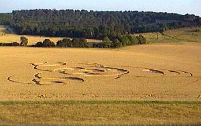
The formation is sitting in a field at the north-eastern
end of the Ridgeway, an ancient path that runs all the way from Alton
Barnes, at the centre of the major UK crop circle area. As far as I know
this is the first formation to appear in this location, although there was
a quintuplet not far away at
Dunstable Downs.
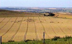
Although smaller than East Field, this field is similar because it is
surrounded by tall hill sides, allowing the formation to be viewed from all
directions.
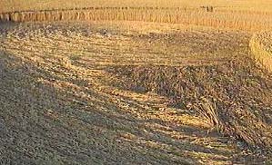
The wheat crop is very much more advanced than the Wiltshire crops. This
shows in a slightly messy lay in some areas. However, other areas of the
formation, like the tear drops have some interesting flows in them. This is
shown in one of the attached photographs.
Report by
Russell Stannard
Location: Ivinghoe Beacon Buckinghamshire (Nr Dunstable)
Map: SP966167
Crop: Wheat
Description: Flattened circle surrounded by 3 spinning tear drops shapes & 3
arms of 2 rings with the over lapping part flattened
Discovery: 26 July 2002
Name: Russell Stannard |