|
|
|
Firle Beacon, nr Lewes .East
Sussex. Reported 7th August.
Map Ref:
GPS
Updated
Friday 16th August
2002

|
|
|

Image David Russell Copyright 2002
|
|
FIRLE BEACON, FIRLE, EAST SUSSEX, 7 AUGUST 2002
Report by ALLAN
BROWN & ANDY THOMAS of Southern Circular Research
Firle Beacon,
about four miles south east of Lewes, is one of highest points in the
area, clearly marked by two distinctive transmission towers, and is a
popular beauty spot boasting impressive views. The last formation in
this general area occurred at nearby Beddingham in 1990, although
Alfriston and Wilmington, other circle sites of old, lie about three
miles east.
The new formation
was found to the east of the road which ascends Firle Beacon on a nice
rounded rise in a very curvaceous field below the South Down's Way
track. There are numerous barrows and tumuli in the area, such as
Firle Long Barrow, Money Burgh and Hunter's Burgh, all important
Neolithic sites. The formation is a simple large ring in wheat, about
140' diameter at its widest, housing (and touching) a smaller offset
ring of 65' with an offset central flattened circle (touching the
smaller ring) of about 32'. The whole rather resembles the 2001
'Angel' formation of Cambridgeshire, but without the radiating lines.
All elements flowed clockwise.
Initial inspection
of the lay reveals an at first rather messy and yet intriguing
effect. The seed heads are somewhat jumbled in places, laying this
way and that. However, in some places on the main ring, particularly
to the east, the lay of the crop is suddenly combed outwards to the
edge for a distance of about 20', instead of continuing the generally
clockwise flow - a very difficult way to lay a ring. There is no
apparent disruption to the smoothness of the ring's trajectory at this
point.

DIAGRAM Allan
Brown Copyright 2002
The central circle, despite the rather poor quality and extreme
brittleness of the crop itself, is impressive, with a pleasingly
chunky standing centre, the lay spiralling out from it to head off
around the first ring. This ring eventually rejoins the central
circle with the lay coming in and on top of the circle flow.
Where the first and second rings meet one another, an interesting
anomaly presents itself. The flow of the inner ring is sliced off
very sharply, allowing the lay of the outer ring to dominate. In fact
the outer ring appears to widen to infill what should have been laid
by the first ring, and then, after traversing this section of the
formation, divides itself back out into two streams, one continuing
around to form the rest of the outer ring, the other continuing the
trajectory of the inner ring, back into and on top of the central
circle.
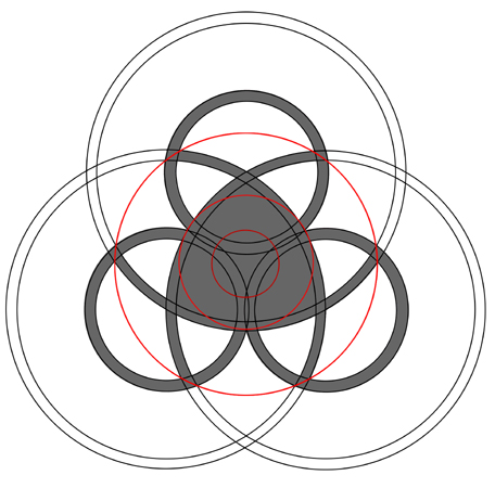
DIAGRAM Allan
Brown Copyright 2002
On first inspection, cow parsley that lay interwoven into the lay in
several places was completely undamaged, showing no bruises or
blemishes, and was continuing to grow and flower quite
happily. However, a significant number of wheat stems were also found
which had actually been tugged right out of the ground, with roots
attached. The laid crop in the formation is bent very low down the
stem, or quite often just bent over right at the base, with none of
the lateral damage that one might expect to find had the crop gone
down in crude manual swathes.
Geometrically, we again seem to have the protocol of the geometry of
one Sussex formation from this season interlocking with that of
another. We have already seen how the Upper Beeding formation
overlaid that of the second Sompting design (without adjusting the
scale). If the various rings and circles of the Firle Beacon emblem
are taken apart and placed concentrically over the second
Sompting formation, they again seem to lock on. There are slight
fluctuations in size, due to thickness of pathways, but essentially
there appears to be a match. (See diagram.)
SURVEYED BY: Allan Brown & Andy Thomas
DIAGRAMS by Allan
Brown
Report by ALLAN
BROWN & ANDY THOMAS, Southern Circular Research/Swirled News
Copyright (C) 2002
Permission must be obtained before reproducing any part of this
report, including photos and diagrams.
|
|
Location: below Firle Beacon, nr Lewes .East Sussex
Crop: wheat ?
Description: large circle with crescents in the middle
Discovery: 7 August 2002( early evening around 8pm)
Name: Stuart Scott |
gallery here
A small circle within a larger circle, very similar in appearance to the Gog/Magog
formation. Some parts of the crop looked quite damaged/worn although this
could be due to the heavy rain in the past few days. The lay was very
impressive and was clockwise in both the outer and inner circles.
Interestingly, the lay seemed to always be slightly biased in pointing East
towards the bottom of the field. Some parts seemed weaved and it felt very
springy and bouncy underfoot. It must be noted that there was heavy wind
damage in other parts of the large field( but not near the formation). An
excellent vantage point of the village of Firle and the Weald, and nearby
Mount Caburn can be seen from the centre. While in the centre, the crop made
a crackling sound similar to what many researchers report, although in this
case I felt that this was just because the sun was out. Easy to get to, but
you need to drive to near the top of the hill to see where about it is
(although it is very close to the road, it is hidden from it). Saw no farmer,
so don't know how his reaction will be!
As you can see, it was a beautiful day, and a welcome break from the rain!
Report by
Benjamin Compson
|
|
 |
