|
CROP CIRCLES IN 1999 |
|
|
CROP CIRCLES IN 1999 |
|
Junction 38 M1, nr West Bratton, West Yorkshire. Reported 22nd June.
Updated Tuesday 17th August 1999
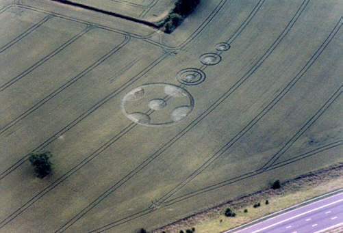
Photo © P.J. Brookman 1999.
|
Image Nick Nicholson (Circular Review) Copyright 1999 CROP FORMATIONS IN SOUTH AND WEST YORKSHIRE, 1999. 2. KEXBOROUGH, SOUTH YORKSHIRE. NORTH WEST OF BARNSLEY. Grid Ref: SE 306 091. FIRST REPORTED SIGHTING: 22nd June 1999. LOCATION: In a field adjacent to west side of M 1, 1 .7 miles south of Junction 38. This is near to the site of a formation which appeared last year. DESCRIPTION: A 27ft. dia. circle surrounded by a ring 5ft. wide, 105ft dia. An outward facing segment of flattened crop is taken out of the standing crop within the ring at 4 points placed symmetrically round the ring. One of the main axes of the circle lies on a tramline, which curves slightly. Further along the tramline are a 2-ringed circle 4Oft. o/a dia.; a one-ringed circle 27ft. u/a diameter. and a one-ringed circle 23 ft. dia. (Dimensions estimated from air photographs). PHOTOGRAPHS: Ground level by Nick Nicholson, air photos by Phil Brookman. .Centre for Crop Circle Studies : East Midlands Branch Tony Caldicott, Branch Co—Ordinator, 514 Moor Road, Bestwood Village. Nottingham NG6 8UN. Telephone: (0115) 979 5333. |
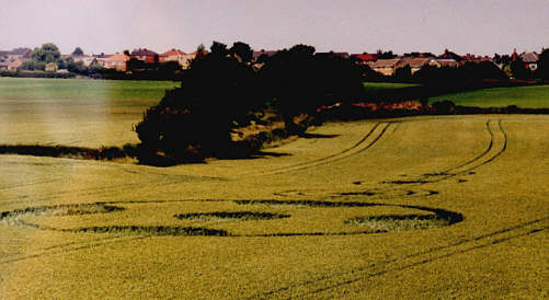
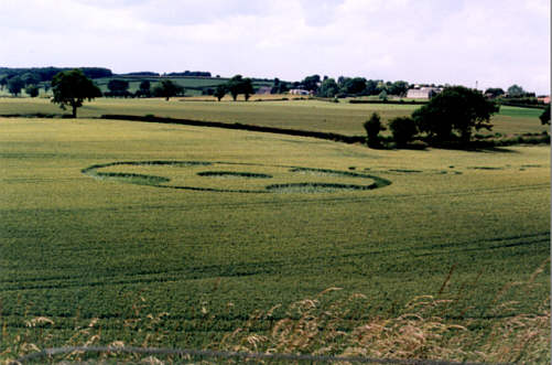
Image Nick Nicholson (Circular Review) Copyright 1999
A series of chained circles with a Maltese Cross at the apex of the field.

